📋 In this article
- -8 exceptional Breton forests Huelgoat, Brocéliande, Quénécan, Camors, Fougères, Cranou, Beffou and Pont-Calleck
- -Interactive Google Maps 20 forests in Brittany with GPS parking and points of interest
- -Interactive route generator 24 forestry routes with duration, level, historical anecdotes and Visorando links
- -Exceptional heritage rocky chaos, Arthurian legends, Neolithic megaliths, 17th-19th century industrial forges
- -Professional photo advice ICM techniques, panoramas, backlighting, golden hour and best light spots
- -Free PDF guide Download photo gallery of the 8 forests in all seasons
🌲 Interactive map: 20 Forests of Brittany
🗺️ Interactive map of Brittany's 20 forests - This map shows the 8 forests detailed in the article plus 12 alternatives to explore. Find car parks with precise GPS coordinates and major points of interest in each forest.
🎲 Want to discover a forest in Brittany? Generate a surprise hike from our 24 most beautiful routes in Brittany's forests - with duration, level of difficulty, professional photo advice and a direct link to Visorando for each forest route.
🌲 Find your next hike in our beautiful Breton forests
Generate a surprise tour from our 30 best itineraries
🌊 Brittany direct to you?
Receive my exclusive articles on Brittany and discover my latest photographs of the region. Every month, you'll find great tips, secret places and my favourite Breton spots.
✓ Exclusive content - ✓ No spam - ✓ Easy unsubscribe
🌲 The 8 Most Beautiful Forests in Brittany
Brittany is home to some exceptional forests where legends, nature and history meet. Here are eight must-see forests with their own special features: rocky chaos, megaliths, historic forges, lakes and family trails. Each forest is presented with its location, car parks, routes and photo tips.
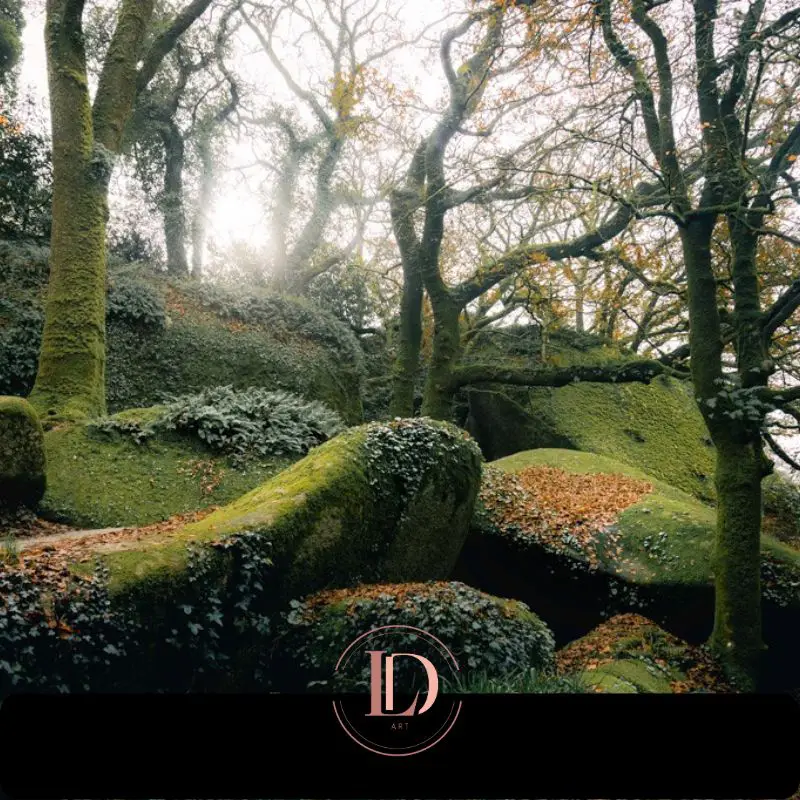
The granite chaos of Huelgoat, Finistère. Loïc Delplanque
🌲 Huelgoat (Finistère) - Le Chaos du Moulin
The Huelgoat Chaos was formed 300 million years ago, when the Earth's crust melted deep underground to form granite. This magma rose and cooled 6-8 km below the surface.
Over millions of years, erosion of the Hercynian chain has exposed this massive granite. Freezing, thawing and weathering then fractured the rock, creating this labyrinth of gigantic boulders - some weighing over 100 tonnes - now embedded in a dense forest.
Caption: Tradition has it that Gargantua knocked on the door of the inhabitants of Huelgoat to ask for lodging. They served him a meagre porridge of buckwheat. Vexed by this minimalist hospitality, the giant set off again towards Léon. To express his displeasure, he emptied his pockets of all the pebbles he had accumulated during his journey, throwing them angrily at the current site of chaos. A memorable anger that shaped the landscape for eternity.
📍 Practical Information
- 📍 Location: Huelgoat, 29690 (Finistère)
- 🅿️ Parking : Rue du Général De Gaulle - Free
- 🌳 Surface area : 1,800 hectares
- ⏱️ Circuits : 1h (family) to 4h (full)
- 📸 Optimum spotlight : Mare aux Sangliers
📍 Remarkable sites
- Chaos du Moulin - Cyclopean granite blocks, a mineral labyrinth
- Mare aux Fées - Natural cave carved by river erosion
- Mare aux Sangliers - Ideal water feature for symmetrical compositions
- Gouffre - Spectacular flow after autumn rainfall
- Artus camp - Gallic fortified enclosure, archaeological remains
- Trembling Rock - 100-tonne block oscillating under manual pressure
📸 Photo Council
Choose misty autumn mornings to recreate the magic of chaos. The low light under the canopy means you need to use a tripod and slow shutter speeds.
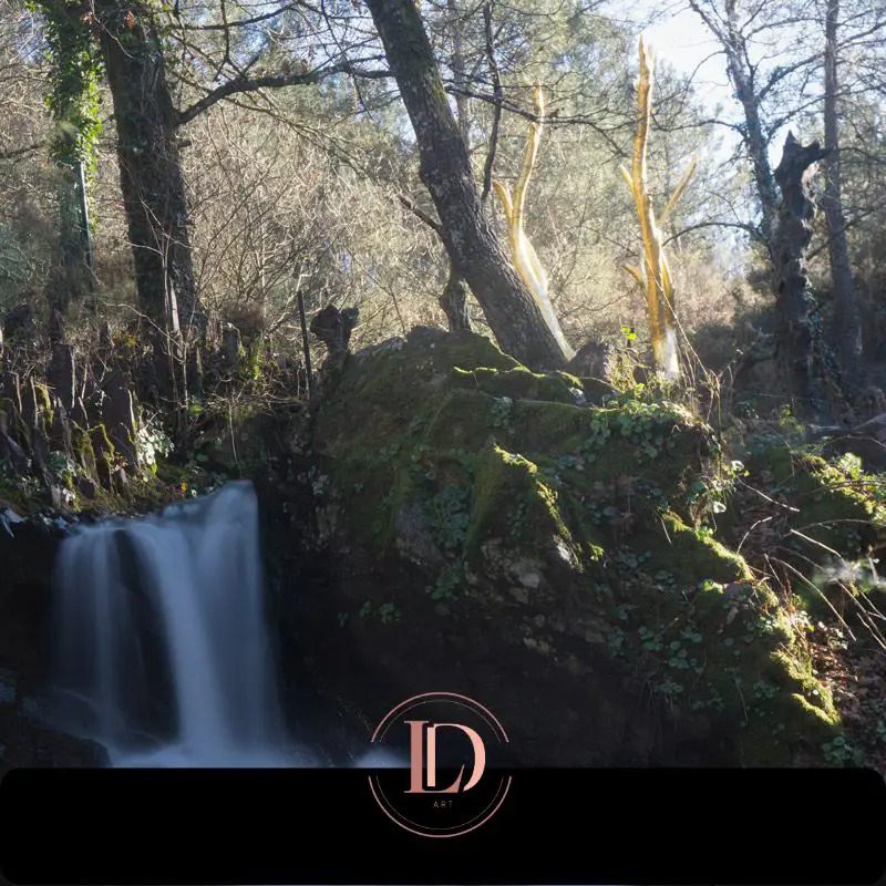
The Golden Tree at Val sans Retour, Brocéliande Forest, Paimpont © Loïc Delplanque
🏰 Brocéliande (Ille-et-Vilaine) - Les Légendes
The forest of Paimpont was known as Brécilien until the 15th century. Its identification with the legendary Brocéliande, an imaginary forest created by Chrétien de Troyes in the 12th century, was established in the mid-19th century thanks to the work of the scholar Félix Bellamy.
The area covers a total of 11,000 hectares, including 7,000 hectares of Arthurian sites. Shaped by three centuries of iron mining (17th-19th centuries), the area is still home to the ruins of old forges and the reservoirs that supplied the foundries with hydraulic power.
Caption: According to Arthurian tradition, the Barenton Fountain marks the first meeting place between Merlin the Enchanter and the fairy Viviane. Considered to be a marvellous fountain, pouring its water over the stone steps was supposed to bring rain. This popular belief led to numerous processions during periods of drought.
📍 Practical Information
- 📍 Location: Paimpont, 35380 (Ille-et-Vilaine)
- 🅿️ Parking : Esplanade de Brocéliande - 48.0199, -2.1719 - Free admission
- 🌳 Surface area : 9,000 hectares
- ⏱️ Circuits : 2h to 6h depending on itinerary
- 📸 Optimum spotlight : Barenton fountain (quiet morning)
📍 Remarkable sites
- Barenton fountain - Legendary spring, Merlin-Viviane meeting
- Guillotin oak - A thousand-year-old tree, a vestige of ancient forests
- Paimpont Abbey - Medieval foundation, historic centre of the massif
- Etang de l'Abbaye - Artificial lake, former forge basin
- Val sans retour - Legendary site linked to the fairy Morgane
- Merlin's tomb - Neolithic dolmen Christianised by legend
📸 Photo Council
Experiment with vertical filming (ICM) to capture the mystical atmosphere of Brocéliande. Set your shutter speed to 1/4s or 1/2s, then move the camera vertically during the exposure. The trunks become blurred lines, creating a dreamlike atmosphere reminiscent of Arthurian legends.
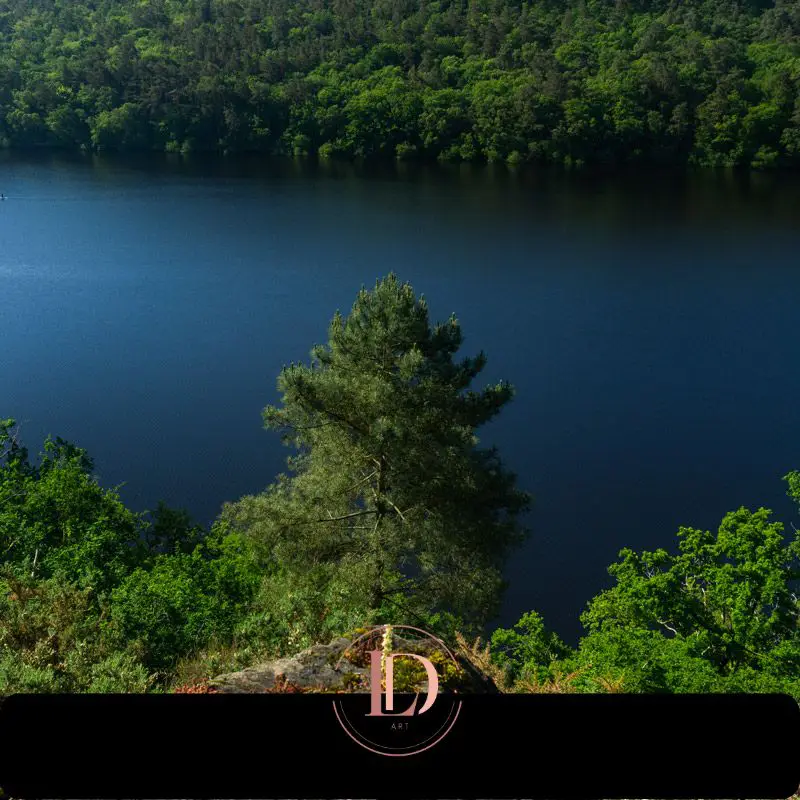
Lake Guerlédan and Quénécan forest, Central Brittany. Loïc Delplanque
⛰️ Quénécan (Morbihan)
The Quénécan forest stretches over 3,700 hectares between Morbihan and Côtes-d'Armor, to the south of Lac de Guerlédan. Nicknamed "Brittany's Little Switzerland" for its undulating terrain, it is home to the Gorges du Daoulas, a natural canyon carved out by the river.
The massif is home to the Forges des Salles, an iron-making village founded in 1622-1623 by Henri II de Rohan. For more than 250 years, blast furnaces and forges transformed the local ore into cast iron using charcoal and hydraulic power.
Production ceased in 1877. The village has been completely restored and can now be visited freely or with a guide.
Industrial Heritage : Henri II de Rohan, a Protestant leader from Brittany, created the Forges des Salles in 1622 to put an end to the anarchic exploitation of local ore and to organise the extraction of iron, wood and water rationally. Blacksmiths, workers, charcoal burners and miners formed a complete village, and the working life of the 18th and 19th centuries has now been restored.
📍 Practical Information
- 📍 Location: Sainte-Brigitte (56) / Perret (22)
- 🅿️ Parking : (48.2149, -3.1298) - Free of charge
- 🌳 Surface area : 3,700 hectares
- ⏱️ Circuits : 2h to 4h depending on itinerary
- 📸 Optimum spotlight : Daoulas gorges (viewpoint)
📍 Remarkable sites
- Daoulas gorges - A natural canyon with steep walls
- Lake Guerlédan - The largest artificial lake in Brittany
- Bon-Repos Abbey - 12th-century Cistercian ruins
- Forges des Salles - Restored steel village, open to visitors
📸 Photo Council
Create a panorama to show the full extent of the gorges. Take several shots by shifting the camera, then stitch them together in post-production.
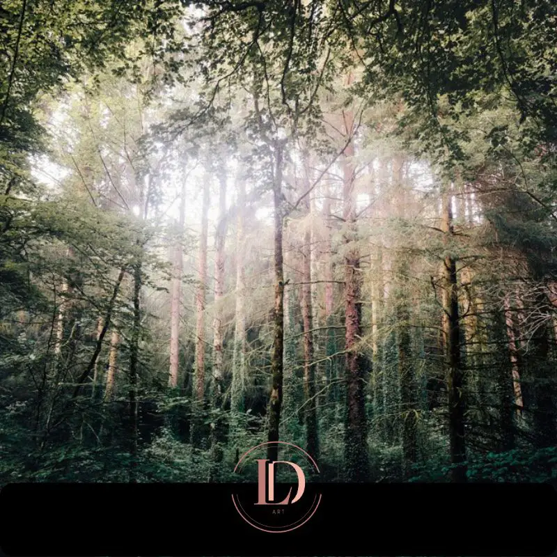
Camors National Forest, Morbihan, Brittany. Loïc Delplanque
🗿 Camors (Morbihan)
The Camors state forest covers 648 hectares in the north of the Auray region. Accessible to all, it offers easy trails and calm ponds ideal for families.
The Camors state forest covers 648 hectares in the north of the AurThe forest is home to a number of Neolithic menhirs erected around 5,000 years ago, which probably marked territories or served as ritual landmarks. The forest boasts a full range of leisure facilities, including picnic areas, children's play areas and a tree climbing course.
Megalithic heritage : The Menhir Braz, nicknamed the "star menhir", measures 3.40 metres. Not far away stands the more modest Menhir Bihan, measuring 1.70 metres. Listed as historic monuments in 1934, they date back 5,000 years.
📍 Practical Information
- 📍 Location: Camors, 56330 (Morbihan)
- 🅿️ Parking : Site du Petit Bois - (47.8446, -3.0137) - Free admission
- 🌳 Surface area : 648 hectares (national forest)
- ⏱️ Circuits : 1 to 3 hours depending on itinerary
- 📸 Optimum spotlight : Étang du Petit Bois (morning reflections)
📍 Remarkable sites
- Braz menhir - Raised stone, 3.40 m high, listed as a historic monument
- Menhir Bihan - Megalith measuring 1.70 m
- Cornevec alignment - Fifty menhirs over 250 m
- Covered walkway at Lann Er Vein - Neolithic burial chamber
- Étang du Petit Bois - Family leisure area
- Tortorec Cross - Old cross in the forest
📸 Photo Council
At dawn, the banks of the lake and the hamlets are adorned with changing reflections. Try your compositions with the first rays filtering through the trees.
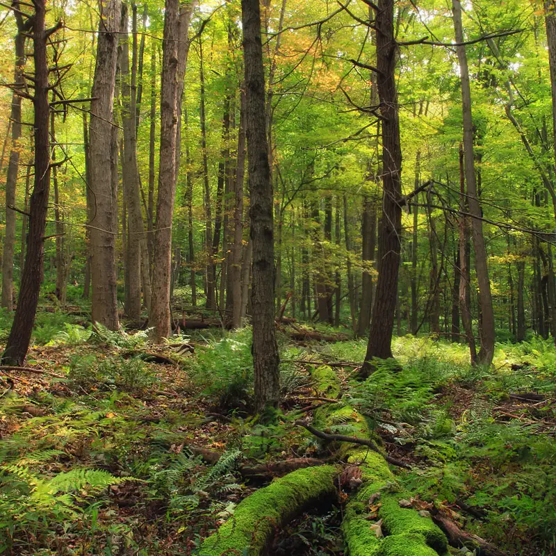
Fougères forest, Ille-et-Vilaine, Brittany. Photo Pixnio CC0 (Public domain)
🌳 Fougères (Ille-et-Vilaine)
The Fougères state forest covers 1,584 hectares to the north of the town, in the municipalities of Landéan and Laignelet. Made up mainly of hundred-year-old beech trees, it is one of the most beautiful beech forests in Brittany. The dense canopy of old beech trees filters out the light, creating a meditative atmosphere ideal for long walks.
Less touristy than Huelgoat or Brocéliande, it offers an authentic immersion in nature. During the Vendée War in 1793, the forest served as a refuge for royalist insurgents at the Battle of Fougères.
Historical heritage : The forest was the scene of the Battle of Fougères on 3 November 1793, during the Galerne expedition in the Vendée War. Royalist troops captured the town after fierce fighting.
📍 Practical Information
- 📍 Location: Landéan / Laignelet, 35133 (Ille-et-Vilaine)
- 🅿️ Parking : Chênedet crossroads (D177) - (48.3948, -1.1736) - Free of charge
- 🌳 Surface area : 1,584 hectares (ONF national forest)
- ⏱️ Circuits : 1 to 4 hours depending on itinerary
- 📸 Optimum spotlight : Sentier de la Pierre Enfouie (undergrowth)
📍 Remarkable sites
- The Buried Stone Trail - Signposted 5.5 km circuit, 1h30
- Centenary beech trees - Majestic trees characteristic of the massif
- Chênedet leisure centre - Pond, supervised swimming in summer
- Cordon des Druides - Alignment of a dozen menhirs
- Pierre Courcoulée (Pierre des Huguenots) - Neolithic megalith
📸 Photo Council
Old beech trees give off a soft, green light. Focus on details with a macro or telephoto lens: bark, roots, carpets of dead leaves.
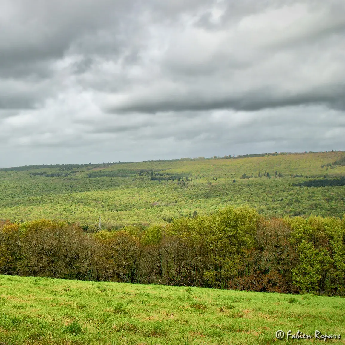
Forêt du Cranou near Quimerc'h, Finistère, Brittany. Photo Wikimedia Commons Fabien Ropars / CC BY-SA 3.0
🌲 Cranou (Finistère) - Forêt Domaniale du Cranou
The Cranou state forest covers 627 hectares between Hanvec and Le Faou, in the Armorique Regional Nature Park. Including the adjacent communal woods and private plots, the total forest covers 1,321 hectares, making the Cranou the largest forest in Finistère.
Its altitude varies from 60 to 321 metres. Less frequented than other Breton forests, it attracts lovers of tranquillity. Crossed by the GR37, it offers a 3km interpretation trail and an 11-hectare forest arboretum.
⚠️ Attention: Since storm Ciaran, some small paths are no longer accessible and several bridges have been destroyed, making it difficult to cross the river without a bridge. The forest remains magnificent and accessible to dogs.
Legend of Saint Conval : Saint Conval, driven out of the Bois du Gars after cutting down the local lord's oak trees, took refuge in the Cranou forest. The new lord gave him permission to use all the trees. As a reward, the saint declared that there would never be a shortage of wood in the Cranou forest.
📍 Practical Information
- 📍 Location: Hanvec / Le Faou, 29460 (Finistère)
- 🅿️ Parking : Route de Rumengol (48.3158, -4.1010) - Free of charge
- 🌳 Surface area : 627 ha (national forest) / 1,321 ha (total forest area)
- ⛰️ Altitude : 60 to 321 metres
- ⏱️ Circuits : 1h to 5h (GR37 + signposted routes)
- 📸 Optimum spotlight : Forest arboretum (diversity of tree species)
📍 Remarkable sites
- Saint-Conval fountain - Listed as a historic monument (1956)
- Saint-Conval Calvary - 1627, kersantite, Roland Doré (only the central column remains)
- Interpretation tour - 3 km signposted
- Forest Arboretum - 11 hectares
- GR37 footpath
📸 Photo Council
Stand at the base of a tall tree and photograph the top from a low angle: the tree dominates the image, accentuating its verticality.
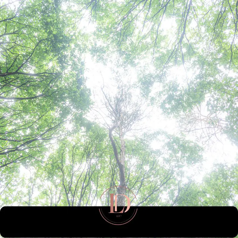
Forêt départementale de Beffou, highest forest in Brittany, Côtes-d'Armor. Loïc Delplanque
🌲 Beffou (Côtes-d'Armor) - The highest forest in Brittany
The Beffou departmental forest covers more than 630 hectares in the municipalities of Loguivy-Plougras, La Chapelle-Neuve and Lohuec. Owned by the département since 1951, it is the highest forest in Brittany, with Le Pavé, the highest peak in Trégor at 322 metres, at its heart.
Managed by the ONF and classified as a sensitive natural area, it is dominated by beech trees (its name means "residence of the beeches" in Breton), with oak, chestnut and yew trees over a hundred years old. The constant humidity and dense canopy create a special atmosphere, with lush moss and subdued light. The Sentier de Job (Job Trail) is a 1.2 km trail through the fauna and flora.
Historical heritage : The forest is home to the Brohet covered walkway (18 metres long, one of the longest in Brittany), a collective grave dating back to the 3rd millennium BC. It is crossed by the old Roman road that linked Le Yaudet to Carhaix. Until the 18th century, Beffou was a thriving metallurgical centre. Coal and clog makers worked here until the early 20th century.
📍 Practical Information
- 📍 Location: Loguivy-Plougras / La Chapelle-Neuve / Lohuec, 22780 (Côtes-d'Armor)
-
🅿️
Parking : RD11 / allée forestière n°25 junction - Free - (48.4911, -3.4807)
- 🌳 Surface area : More than 630 hectares (departmental forest)
- ⛰️ Altitude : Highest point at 322 metres (le Pavé)
- ⏱️ Circuits : 1 to 3 hours depending on route
- 📸 Optimum spotlight : Job trail (yew and moss)
📍 Remarkable sites
- Job's path - Interpretation trail 1.2 km, 1 hour
- Le Pavé - Highest point in Trégor at 322 m
- Allée couverte du Brohet - 18 m long (Neolithic tomb)
- Centenary yews - Sacred trees of the Celts
- Clogmaker's hut - Historical reconstruction
📸 Photo Council
For macros with soft, pastel bokeh, shoot in the undergrowth in the morning or at the end of the day when the ambient light is low. Use a wide aperture (f/2.8 to f/4) with a macro lens to isolate moss, fungi or insects from the background. Position yourself close to the subject with a distant, solid-coloured background: the diffuse green tones of the foliage will create dreamlike bubbles of light. Avoid direct sunlight.
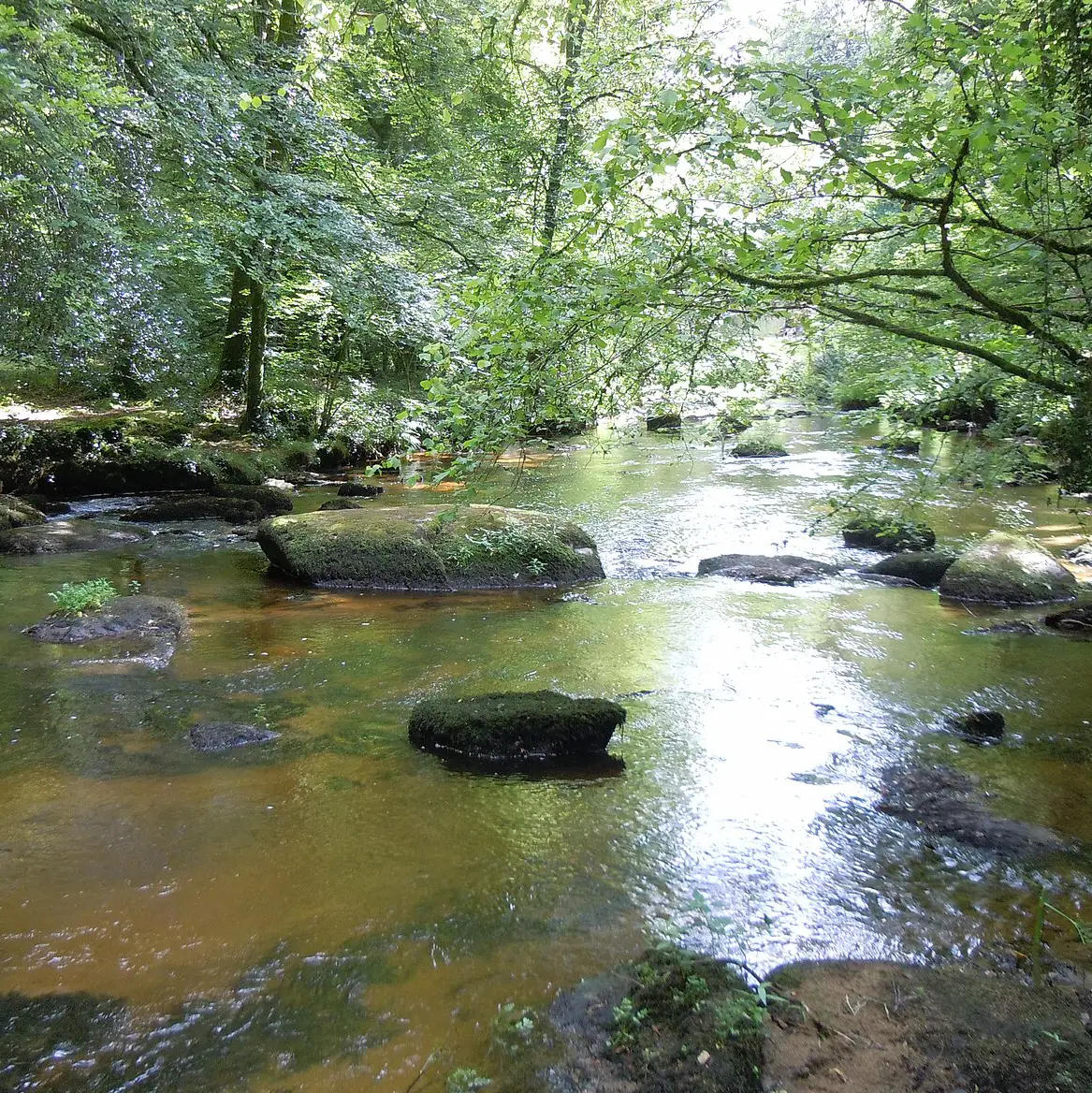
Pontcallec river in the Berné forest, Morbihan. Photo Wikimedia Commons Lanzonnet / CC BY-SA 3.0
🌲 Pontcallec (Morbihan) - Forêt Domaniale de Pont-Calleck
The Pont-Calleck state forest covers 541 hectares in the commune of Berné. Formerly owned by the Marquisate of Pontcallec, it became state property in 1963 and has been managed by the ONF since 1966. Listed as a Natura 2000 site, it occupies a plateau and hillsides on the right bank of the river Scorff, renowned for its trout, salmon and otters.
The poor, acidic granite soil is home mainly to pedunculate oak, beech and chestnut trees. The maximum altitude is 164 metres.
Historical heritage : The Pontkalleg valley preserves traces of the ancient seigneury established in 1281. The estate is home to Pontcalleck castle (private, closed in August), the chapels of Saint-Albaud and Sainte-Anne des Bois, the remains of a medieval hamlet, as well as the site of the old pond and the remains of the old forges that exploited the local wood and water from the Scorff.
📍 Practical Information
- 📍 Location: Berné, 56240 (Morbihan)
-
🅿️
Parking : Maison Forestière roundabout near Pont-Neuf (D110 & D204) - (47.9434, -3.3606) - Free of charge
- 🌳 Surface area : 541 hectares (national forest)
- ⛰️ Altitude : Maximum 164 metres
- ⏱️ Circuits : 1h30 to 4h (16.9km Pontkalleg circuit)
- 📸 Optimum spotlight : Site of the old pond
📍 Remarkable sites
- River le Scorff - Salmon, trout and otters (Natura 2000)
- Pontcalleck Castle - Private property (closed in August)
- Saint-Albaud Chapel - Religious heritage
- Sainte-Anne des Bois Chapel - Built in 1865
- Medieval hamlet - 13th century remains
- Site of the old pond - Historical landscape
- Remains of the forges - Metallurgical activity
📸 Photo Council
Polarising filter for your photographs on the river.
🌲 And now?
These 8 forests offer the best of Brittany. From the rocky chaos of Huelgoat to the beech forests of Fougères, from the legends of Brocéliande to the wild gorges of Quénécan, each has its own character. Choose your forest for your next weekend walk or hike.
If you were interested in this article, check out my photographs of Brittany.
❓ Frequently Asked Questions
What is the most beautiful forest in Brittany?
Brocéliande remains the most emblematic with its Arthurian legends. Huelgoat impresses with its unique rocky chaos. Fougères seduces with its majestic beech forests. The choice is up to you: mystery, geology or wilderness.









0 Comments