
Certaines des photographies présentes dans cet article sont disponibles à la vente en tirages limités , et ont été réalisées par Loïc Delplanque, photographe professionnel dans le Morbihan.
Introduction

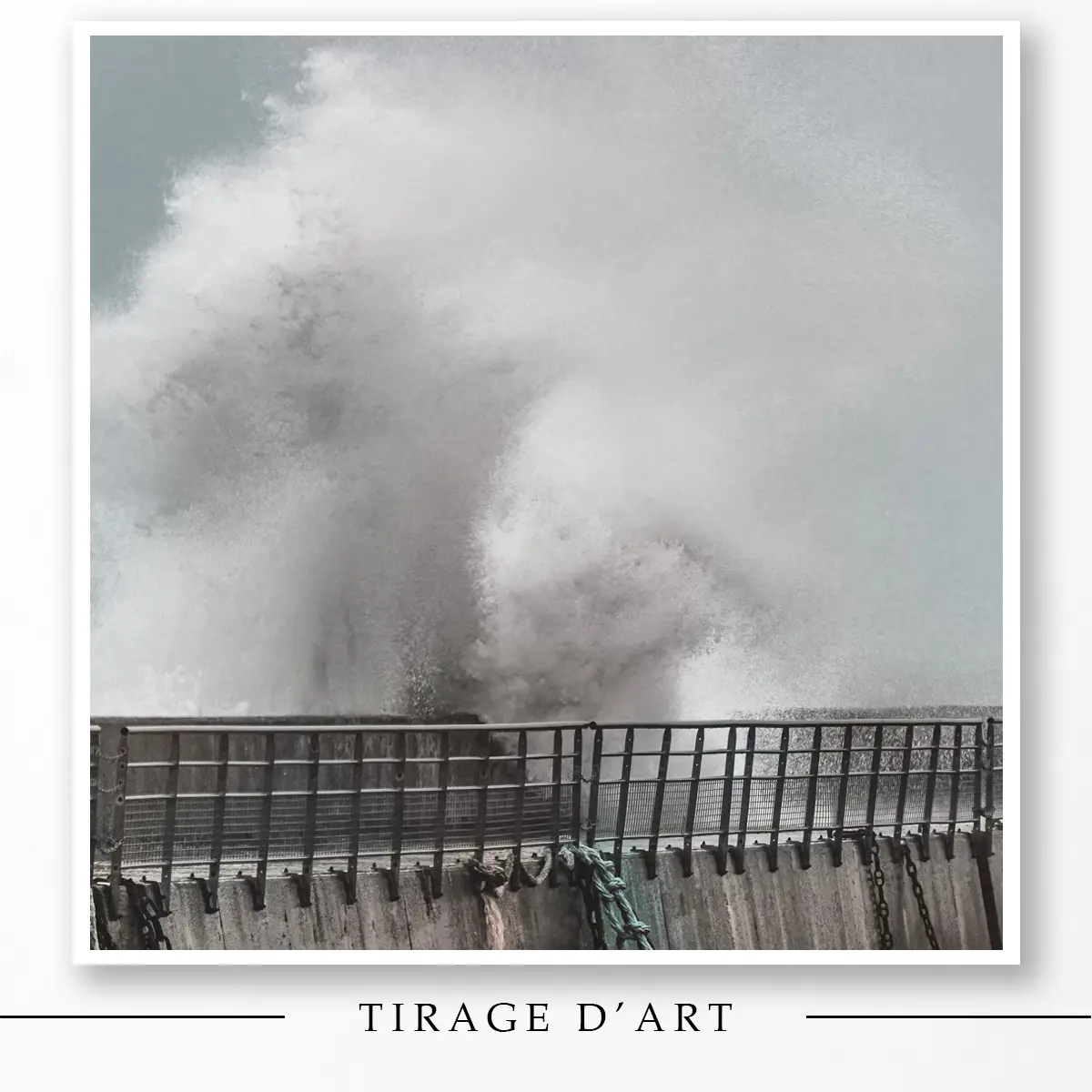
Photographie réalisée par Loïc Delplanque, le 30 janvier 2021, lors de la tempête Justine au Conquet. Une vague colossale s’écrase sur la digue.
Ces phénomènes font partie du quotidien en Bretagne. Elles fascinent, inquiètent, sidèrent… Et alors qu’on finit parfois par ne plus y prêter attention, elles nous rappellent notre fragilité et interrogent notre lien à la nature.
Cet article revient sur la formation des tempêtes et celles qui ont marqué la Bretagne au fil des années.
Il aborde leurs conséquences sur le littoral, les risques accrus liés au climat, et la façon dont la région s’adapte face à l’érosion.
Située à la jonction de la Manche et de l’Atlantique, elle subit régulièrement les effets de dépressions très actives venues de l’Atlantique Nord. Vents violents, houle impressionnante, inondations ou coupures de courant : chaque hiver apporte son lot d’intempéries.
Ciaran, Lothar et d’autres événements marquants ont laissé des traces visibles sur le littoral, mais aussi dans la mémoire collective.
Outils Météo Tempêtes Bretagne : Suivi en Temps Réel

Météo Bretagne
Ciel dégagé
🌡️ 21°C (ressenti 21°C)
🌬️ Vent : 3 km/h direction NNE | Rafales : 11 km/h
💧 Humidité : 73%
🔽 Pression : 1017 hPa
👁️ Visibilité : 10 km
Ciel dégagé
🌡️ 24°C (ressenti 24°C)
🌬️ Vent : 9 km/h direction OSO | Rafales : 6 km/h
💧 Humidité : 46%
🔽 Pression : 1016 hPa
👁️ Visibilité : 10 km
Ciel dégagé
🌡️ 30°C (ressenti 29°C)
🌬️ Vent : 18 km/h direction NNE | Rafales : 13 km/h
💧 Humidité : 35%
🔽 Pression : 1016 hPa
👁️ Visibilité : 10 km
Partiellement nuageux
🌡️ 27°C (ressenti 27°C)
🌬️ Vent : 9 km/h direction ONO | Rafales : 10 km/h
💧 Humidité : 35%
🔽 Pression : 1015 hPa
👁️ Visibilité : 10 km
Calculateur de Force du Vent
Indiquez simplement la vitesse du vent : le calculateur affiche directement sa force sur l’échelle de Beaufort. Pratique pour mieux visualiser ce que signifie vraiment un vent à 70 km/h.
🌊 Tempêtes Historiques de Bretagne
Les événements météorologiques qui ont marqué la région depuis 1984
Les tempêtes bretonnes naissent en Atlantique Nord, générées par des dépressions issues des écarts thermiques entre pôles et tropiques. Le courant-jet les dirige vers l’Europe, avec vents violents. La Bretagne, pointe occidentale de France, se trouve en première ligne face à ces phénomènes.
Depuis 1980, 182 tempêtes ont frappé la Bretagne, selon Météo-France. D’après Météo Bretagne, la moyenne est de trois par an. L’ouragan de 1987, avec ses vents à 216 km/h, reste gravée dans les mémoires. Des archives évoquent déjà un épisode majeur dès 1287.
 Phares en Bretagne
Complétez votre lecture sur les tempêtes bretonnes
Pour prolonger cette immersion dans les mers agitéees, découvrez notre article dédié aux phares en Bretagne : histoire, accès et idées de balades autour des sentinelles qui veillent sur la côte par tous les temps.
Lire l’article sur les phares en Bretagne7 tempêtes mémorables en Bretagne

novembre 1984
Les 22 et 23 novembre 1984, deux tempêtes ont frappé la moitié nord de la France et particulièrement la Bretagne. À cette époque, leur donner un nom ne se faisait pas encore en France ou en Europe.
La nuit du 23 au 24 novembre 1984 restera gravée dans les annales météorologiques bretonnes. Un épisode d’une rare intensité s’est abattu sur la région, provoquant d’importants dégâts et des inondations le long des côtes.
Les rafales ont dépassé les 150 km/h sur le littoral breton, avec des pointes allant jusqu’à 175 km/h par endroits.
Le centre-ville de Landerneau, dans le Finistère, s’est retrouvé sous les eaux. Les vagues déchaînées ont projeté des tonnes de galets sur les côtes, modifiant le paysage du littoral.
Ces vents extrêmes ont arraché des arbres, endommagé des bâtiments et perturbé les infrastructures.
Ouragan d’octobre 1987
La tempête de 1987, surnommée l’« Ouragan de 1987 », a frappé la Bretagne et la Normandie avec une violence exceptionnelle, laissant une marque indélébile dans l’histoire météorologique de la région.
Un épisode météo hors norme
Dans la nuit du 15 au 16 octobre 1987, une dépression explosive a balayé le nord-ouest de la France, provoquant des vents d’une intensité exceptionnelle. En Bretagne, des rafales ont été mesurées à 200 km/h à Ouessant et 187 km/h à Quimper.
Mais c’est à Granville, sur la côte voisine, qu’a été enregistré le record absolu de 216 km/h – une valeur toujours invaincue à ce jour, même après le passage de Ciaran en 2023.
Elle a laissé une empreinte durable : un quart des forêts bretonnes a été détruit, des dizaines de milliers d’habitations ont été privées d’électricité, et les dégâts matériels ont été estimés à près de 23 milliards de francs à l’échelle nationale.

Cette infographie illustrée évoque les conséquences d’une tempête sur les côtes bretonnes.
Le paysage breton a été profondément modifié. “Le paysage ressemblait à un champ de ruines, comme à Verdun”, se souviennent certains habitants, frappés par l’ampleur des dégâts. (source La chaîne météo)
Malgré son intensité, le nombre de victimes est resté relativement limité en raison d’un passage nocturne et d’un faible coefficient de marée. Pour de nombreux habitants, cette nuit reste l’un des épisodes météorologiques les plus marquants du siècle.
Des dégâts considérables
L’impact a été dévastateur :
- 15 personnes ont perdu la vie en France.
- Les dégâts ont été estimés à environ 23 milliards de francs de l’époque, soit 3,5 milliards d’euros.
- Près d’un quart des forêts bretonnes a été détruit.
Un phénomène météorologique exceptionnel !
Souvent qualifiée à tort d’ouragan, il s’agissait en réalité d’une dépression des latitudes moyennes, d’une intensité rare. Sa pression atmosphérique est descendue jusqu’à 948 hPa à Brest, un record depuis la création de la station en 1945. Sa vitesse de déplacement, environ 110 km/h, a contribué à amplifier les effets dévastateurs.
Un tournant dans la gestion des tempêtes
Cet événement climatique extrême a marqué un tournant dans la prise de conscience des menaces météorologiques en Bretagne et en Normandie.
Il a conduit à une amélioration des systèmes d’alerte et à une meilleure préparation face aux tempêtes.
Paradoxalement, dix ans après la catastrophe, le bilan forestier s’est avéré positif, avec un reboisement presque complet des zones détruites et l’apparition de 30 000 hectares de nouvelles forêts.
L’ouragan d’octobre 1987 reste gravé dans la mémoire collective comme un rappel de la puissance de la nature et de la nécessité d’une vigilance constante face aux phénomènes météorologiques extrêmes.
Daria (25 et 26 janvier 1990)

Daria en janvier 1990 : tempête de sable sur le Boulevard Barnaart (Pays-Bas), vent force 12. Fotopersbureau de Boer
25–26 janvier 1990. La tempête Daria, qu’on appelle aussi Burns’ Day Storm, a lancé un hiver que bien des Bretons n’oublieront pas. Cette « bombe cyclonique » a frappé fort, avec des rafales mesurées à 176 km/h à la Pointe du Raz et une houle violente qui a secoué tout le littoral de la Manche à l’Atlantique (source : Wikipédia).
Et ce n’était que le début. Daria a ouvert la voie à une série impressionnante d’au moins dix tempêtes, parmi lesquelles Vivian, Herta et Wiebke, venues balayer les forêts, déstabiliser les réseaux électriques, et s’inscrire durablement dans les souvenirs de ceux qui les ont traversées (source : Wikipédia).
93 morts en six pays. Daria n’a pas seulement secoué les toits, elle a bouleversé des vies. On compte 45 décès au Royaume-Uni, 19 aux Pays-Bas, 10 en Belgique, 8 en France, 7 en Allemagne et 4 au Danemark. Un épisode brutal, dont les conséquences humaines ont marqué l’Europe (source : Wikipédia).
Herta (3 février 1990)

19/20 FR3 du 4 février 1990 – Herta, un épisode meurtrier sur la France.
Archive INA, disponible sur YouTube.
Herta a frappé la France en pleine journée, un passage peu courant pour ce type de phénomène.
Des vents dévastateurs
Ce fut la seconde plus forte tempête en 50 ans dans la moitié nord.
Dès 9 h, des vents extrêmement puissants ont balayé la Bretagne, atteignant 167 km/h à la pointe du Raz et 162 km/h à Belle-Île-en-Mer. Parallèlement, la Normandie a été touchée par des rafales allant jusqu’à 170 km/h à Granville.
En avançant dans les terres, les rafales ont atteint 133 km/h à Nantes (Pays de la Loire) et 151 km/h au Cap de la Hève, près du Havre en Seine-Maritime (Normandie). Herta a ensuite frappé l’Île-de-France, où les vents ont culminé à 158 km/h à Brétigny-sur-Orge.
Un bilan humain et matériel lourd
En France, 23 personnes ont perdu la vie ce jour-là. Parmi les régions les plus touchées, la Bretagne n’a pas été épargnée.
À Herbignac, un habitant raconte :
« Le vent soufflait à plus de 120 km/h en continu, avec des rafales à 140 km/h ; une énorme branche presque aussi large que la route est tombée derrière ma voiture… Ma femme tremblait de peur, et scrutait les vitres en espérant qu’elles résistent. » (source : infoclimat)
À Pipriac, un chauffeur routier a perdu la vie après la chute d’un arbre. Trois autres personnes ont été grièvement blessées par des baies vitrées soufflées en pleine tempête.
Les dommages matériels ont été importants : l’église de Brielles a perdu son clocher, des bâtiments ont été endommagés à Rennes, et des commerces ont subi des dégâts à Cancale et Vitré. Partout dans la région, de nombreux arbres ont été déracinés. (source : Ouest France)
Lothar et Martin (décembre 1999)
")
Dégâts à Angoulême, au matin du 28 décembre 1999, après la tempête Martin.
Nicolas Dessaux — Travail personnel
Lothar et Martin, qui ont frappé la Bretagne les 26 et 27 décembre 1999, ont marqué l’histoire de la région par leur violence exceptionnelle. Ces événements météorologiques ont été qualifiés de « tempêtes du siècle » en raison de leur intensité et de leurs impacts considérables.
Elles ont causé la mort de 140 personnes en Europe, dont 92 rien qu’en France.
Des forêts entières ont été détruites, des fermes gravement endommagées, et des toits arrachés. Le réseau électrique a subi de lourdes conséquences, laissant certaines villes, dont Rennes, sans courant pendant un moment.
Un accident dramatique faisant 4 victimes sur la RN12 vient rappeler la brutalité des événements. Plus de 150 000 foyers sans électricité, des secours débordés… Lothar n’a duré que quelques heures, mais son passage a laissé une région sonnée. Comme en témoigne cette vidéo.
Lothar a touché les côtes bretonnes le 26 décembre, apportant des vents d’une force extraordinaire.
Des rafales record ont été enregistrées :
- 184 km/h sur l’île d’Ouessant
- 173 km/h à Saint-Brieuc, constituant le record régional pour cet événement
- 158 km/h à Pleyber-Christ
Les témoignages autour de Lothar sont nombreux, et disent tous la même chose : personne n’était prêt à une telle violence.
Dans la nuit du 26 décembre 1999, la Bretagne est frappée de plein fouet. Dans le Trégor, les habitants se réveillent au son des rafales, découvrant au petit matin des toitures envolées, des routes bloquées et des arbres à terre.
Martin a suivi le lendemain, le 27 décembre, affectant particulièrement le sud de la Bretagne.
Elle touche une zone plus au sud de la Bretagne que la première, mais avec une force semblable.
Elle impacte moins durement la région, mais la Loire-Atlantique subit d’importants dégâts, notamment dans ses forêts.
Le réseau électrique est une nouvelle fois touché, tandis que les estuaires et les côtes connaissent des inondations.
En Ille-et-Vilaine, les dégâts ont été nombreux, et cinq personnes ont perdu la vie : quatre dans un véhicule percuté par des arbres à Montauban, une autre à Boussac, après l’effondrement du toit de sa maison.
(sources : La chaîne météo) – Voir des photographies de tempêtes en Bretagne
Justine (30 janvier 2021)

Le 30 janvier 2021, tempête Justine au Conquet. Une vague puissante se dresse, évoquant la silhouette d’un dragon. Photographie de Loïc Delplanque
Loïc Delplanque : « Lors de la tempête Justine, les vagues frappaient plus fort qu’à l’ordinaire. Ruisselant, j’allais repartir à la voiture quand il sortit des flots. Ce qu’il y a de beau avec les vagues, hormis la puissance qui émane d’elles, c’est l’imaginaire qu’elles suscitent. Certains y verront une simple vague, j’y vois un dragon sorti des mers. Et vous, que voyez-vous dans cette photo ? »
Justine a frappé la Bretagne le 31 janvier 2021.
Avec des vents atteignant près de 150 km/h, elle a provoqué des inondations, des coupures d’électricité et des dégâts matériels.
Les côtes bretonnes ont été violemment battues par des vagues impressionnantes. Les habitants ont dû faire face à des conditions météorologiques extrêmes, rappelant la vulnérabilité de l’homme face à la nature.
Ciarán (1ᵉʳ au 2 novembre 2023)
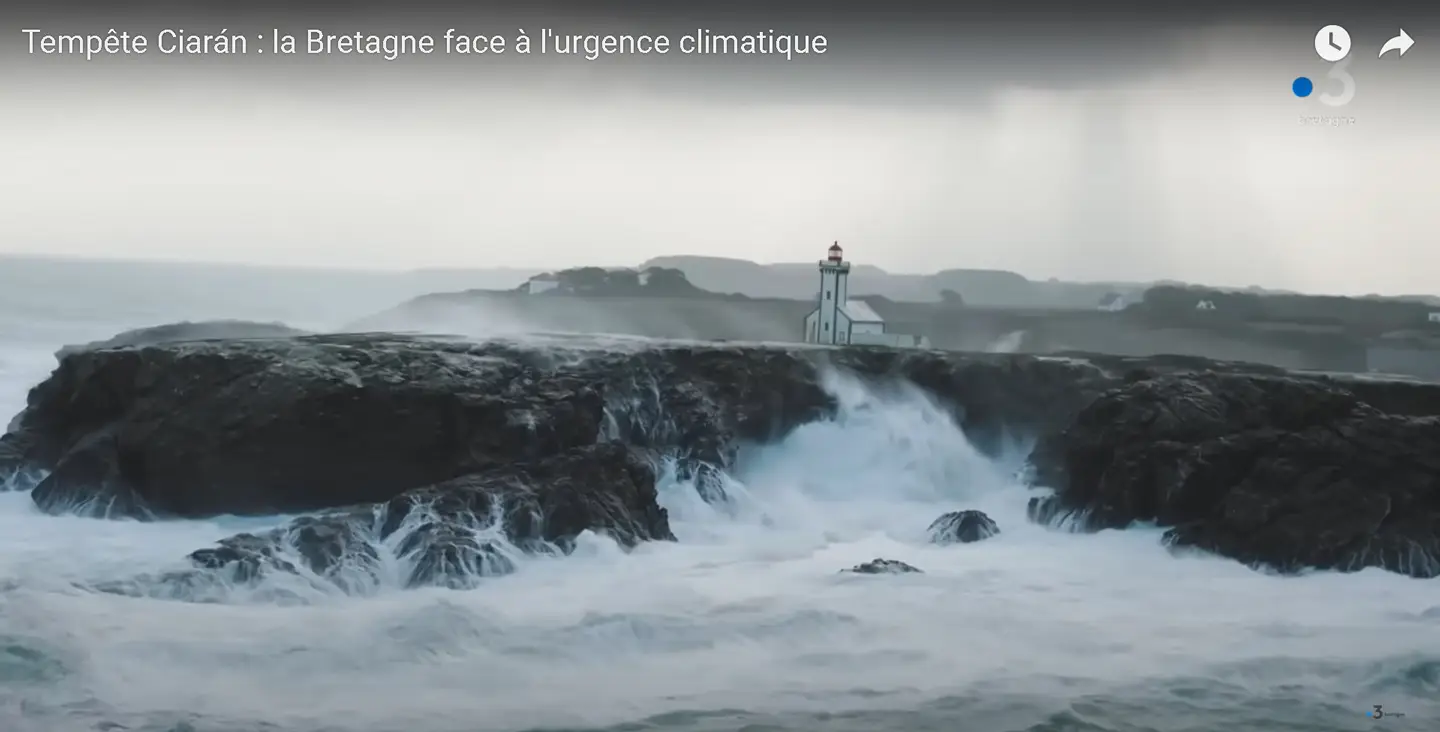
Enquêtes de région Le Mag : Tempête Ciarán – la Bretagne face à l'urgence climatique.
Reportage diffusé sur France 3 Bretagne, présenté par A. Masteau.
Un an après la nuit du 1er au 2 novembre 2023, ce documentaire revient sur les conséquences humaines, économiques et climatiques de Ciarán dans le nord-ouest de la France.
Ciarán, dans la nuit du 1er au 2 novembre 2023, s’est distinguée par une violence exceptionnelle. Certains médias n’ont pas hésité à la qualifier de « tempête du siècle ».
Quatre personnes ont perdu la vie en France lors du passage de Ciarán. En Bretagne, un technicien d’Enedis est décédé à Pont-Aven, alors qu’il intervenait pour rétablir l’électricité.
Des vents d’une force extraordinaire
Ciarán a généré des rafales de vent d’une intensité rarement observée en Bretagne :
- 207 km/h enregistrés à la Pointe du Raz dans le Finistère, établissant un nouveau record
- 193 km/h mesurés à Plougonvelin, également dans le Finistère
- 180 km/h relevés sur l’île de Bréhat dans les Côtes d’Armor
Même à l’intérieur des terres, les vents sont restés très violents :
- 125 km/h à Rostrenen dans les Côtes d’Armor
- 108 km/h enregistrés à Rennes en Ille-et-Vilaine
Des dommages importants
Les conséquences de Ciarán ont été dévastatrices pour la région :
- De nombreux arbres déracinés et des toitures endommagées
- Des routes coupées et des ports de plaisance dévastés
- Environ 1,2 million de foyers privés d’électricité en France, dont une grande partie en Bretagne
Je suis allé sur la presqu’île de Perharidy, quelques jours après la tempête. Elle avait laissé des traces partout. Des arbres couchés par dizaines, les chemins barrés, les talus éventrés. Un spectacle de désolation.
On entend souvent parler des vents à plus de 200 km/h, des coupures de courant ou des dégâts matériels. Mais quand on est sur place, que l’on voit ces paysages familiers défigurés, cela vous prend aux tripes. Chaque arbre au sol rappelle à quel point tout peut basculer en une nuit.
Ce jour-là, j’ai aussi appris que le hêtre de Ponthus, dans la forêt de Brocéliande, avait lui aussi été abattu. Un arbre emblématique, chargé d’histoires, de balades, de souvenirs pour beaucoup.
Statistiques marquantes
Quand on parle de tempêtes en Bretagne, on pense souvent au vent. Mais il n’y a pas que les rafales. Certaines données sont tout aussi impressionnantes

Illustration d’un phare breton face aux intempéries : quand la mer frappe sans relâche pendant un coup de vent hivernal.
Des vagues hors norme
Voici quelques chiffres records liés aux vagues observées ces dernières décennies sur les côtes bretonnes. Toutes ces hauteurs sont issues de mesures précises ou d’estimations fiables :
– 24,60 mètres. C’est la hauteur d’une vague enregistrée au phare de la Jument durant l’hiver 2017-2018.
Des capteurs installés sur place, associés à un système d’analyse d’images, ont permis de la mesurer avec précision. Quand on pense à l’isolement de ce phare en pleine mer, on imagine ce que l’on doit ressentir face à une telle masse d’eau, dans le bruit, le vent, et les embruns.
(Source : campagne de mesure sur le phare de la Jument, hiver 2017‑2018 – voir également fiche Wikipédia du phare)
– 21,1 mètres. C’est la hauteur d’une vague mesurée au large du Finistère pendant le passage de la tempête Ciaran, dans la nuit du 1er au 2 novembre 2023.
Cette valeur a été enregistrée près de la bouée des Pierres Noires, au sud d’Ouessant, le point le plus à l’ouest de la France métropolitaine.
La hauteur significative des vagues atteignait déjà 11,7 mètres, mais cette déferlante isolée a franchi les 21 mètres, soit l’équivalent d’un immeuble de six étages.
Une donnée impressionnante, qui rappelle la violence des phénomènes sur cette partie de la côte exposée aux grandes houles de l’Atlantique Nord.
Dans les terres aussi, l’impact a été brutal.
À Guingamp, Aurélie, 48 ans, raconte avoir été réveillée à 4 heures du matin par « un énorme bruit ». Un arbre dans son jardin s’est fendu en deux : « Ce n’est pas passé loin. À quelques degrés près, c’était la catastrophe… »
(Sources : La Chaîne Météo et Le Parisien via témoignage d’Aurélie)
– 23,60 mètres. C’est ce qu’a mesuré la bouée des Pierres Noires pendant la tempête Petra, au large de Molène, début février 2014.
Pendant plus de dix heures, les vagues sont restées au-dessus des 14 mètres. Une violence qui ne s’est pas arrêtée en mer.
À Lomener, Ambroise Le Floc’h raconte : « le vent dans les volets, avec les volets qui claquent beaucoup ; on entend la houle qui frappe la digue… ».
(Sources : Infoclimat, Le Point)
– 16 mètres. C’est la taille des vagues enregistrées à Ouessant et Belle‑Île‑en‑Mer pendant la tempête du 16 octobre 1987, poussées par une houle longue et puissante le long de tout le littoral breton.
Le niveau de la mer est monté de 1,7 m à Brest et au Conquet, malgré un coefficient de marée faible.

Plusieurs habitants s’en souviennent encore :
« …Ma grand‑mère habitait à Cancale : sa maison tremblait sous les rafales, jusqu’à son lit. Même les vitres vibraient », raconte un membre d’Infoclimat, évoquant cette nuit où les « cannonnades » de vent faisaient rage et que tous les bateaux du port de Concarneau s’étaient retrouvés accrochés aux remparts.
Une nuit où la mer et le vent parlaient fort — et où toute la Bretagne a dû écouter.
(Sources : Wikipédia, Infoclimat)
– 17,7 mètres au-dessus du niveau de la mer – Phare de la Jument
Le 3 janvier 2018, au phare de la Jument à Ouessant, plusieurs vagues exceptionnellement hautes — appelées “scélérates” — ont été observées. L’une d’elles a atteint 17,7 mètres au-dessus du niveau de la mer, soit la hauteur de sa crête. La plus impressionnante, ce jour-là, a été mesurée à 24,6 mètres de creux à crête.
(Sources : Wikipédia)
Où observer les tempêtes en Bretagne ?
Les zones les plus exposées
La Bretagne fait partie des régions les plus exposées aux tempêtes, surtout sur ses côtes.
Des lieux comme la Pointe du Raz, Ouessant, la presqu’île de Crozon ou la baie du Mont-Saint-Michel subissent régulièrement des conditions extrêmes. Les vents violents, les fortes vagues, les marées exceptionnelles et les submersions s’y enchaînent à chaque saison.
Lors d’épisodes comme Ciarán, ces zones ont été particulièrement touchées. Certaines villes portuaires, comme Brest, Lorient ou Saint-Malo, essuient régulièrement des dégâts matériels importants.
Quant aux estuaires et aux zones basses, ils restent vulnérables aux inondations. Face à ces multiples dangers, les autorités rappellent l’importance d’une vigilance constante.
Le phare du Four

Photographie prise le 29 janvier 2020 par Loïc Delplanque, le 30 janvier 2021, lors de la tempête Justine au Conquet. Une vague colossale s’écrase sur la digue, lors d’une violente tempête au large du phare du Four. Sa version encadrée est exposée juste à côté.
Le phare du Four, bien connu pour les vagues immenses qui viennent se fracasser contre ses murs lors des tempêtes. Allumé pour la première fois en mars 1874, il se situe entre la Manche et l’Atlantique.
Il est visible depuis le GR34 à Landunvez et Porspoder. Construit en quatre ans sur la roche du Four, il ressemble au phare des Pierres Noires. Ces deux phares jumeaux guident les marins dans le dangereux chenal du Four.
Au phare du Four, le spectacle impressionne autant qu’il inquiète. Ces phénomènes peuvent aussi être meurtriers.
Le 27 avril 1873, alors que la construction du phare n’était pas encore achevée, une « lame sourde » a fait chavirer un bateau transportant vivres et matériaux, causant la mort de trois marins.
Malgré les assauts répétés des éléments, le phare du Four a résisté aux conditions les plus extrêmes.
Sa construction robuste et sa position stratégique lui ont permis de tenir bon face aux caprices de la mer d’Iroise.
Certaines traces, pourtant, restent visibles : le 1er février 1904, la foudre l’a frappé, causant d’importants dégâts.
Aujourd’hui encore, le phare du Four reste un symbole de résilience face aux aux assauts des vagues.
La côte sauvage du Morbihan

Photographie prise le 21 octobre 2022 par Loïc Delplanque sur la côte sauvage du Morbihan. Une vague immense submerge un rocher au large.
La côte sauvage du Morbihan, avec ses falaises abruptes et ses plages isolées, est souvent exposée aux éléments déchaînés, particulièrement durant la saison hivernale.
Ces phénomènes météorologiques extrêmes se caractérisent par des vents puissants et des vagues impressionnantes qui façonnent le paysage côtier.
Les tempêtes sur cette côte peuvent générer des rafales dépassant fréquemment les 100 km/h, avec des records atteignant parfois 150 km/h lors des épisodes les plus intenses.
Ces vents violents, combinés à la topographie particulière de la côte, créent des conditions maritimes spectaculaires et dangereuses.
Les vagues générées par ces tempêtes peuvent atteindre des hauteurs considérables, parfois supérieures à 10 mètres.
Ces conditions extrêmes attirent souvent des curieux et des photographes, mais représentent un réel danger pour la sécurité des personnes et des infrastructures côtières.
Les autorités locales prennent régulièrement des mesures de précaution lors de ces événements, comme la fermeture de certains accès à la côte ou l’émission d’alertes à la population.
La Côte Sauvage du Morbihan vit aussi au rythme de ces phénomènes, parfois violents.
Tempêtes et climat : comprendre les enjeux

Illustration maritime – Un voilier navigue près d’un phare sous le soleil.
Le rôle du changement climatique
Le changement climatique se fait déjà sentir en Bretagne, avec un réchauffement de +1,4 °C depuis les années 1960. D’ici 2100, la hausse pourrait atteindre +4 °C.
Des années comme 2022, jugées très chaudes aujourd’hui, deviendraient alors des années plutôt fraîches.
Les sécheresses seront plus longues et plus intenses : les sols resteront secs un mois de plus, et leur intensité pourrait grimper de 47 %. À l’inverse, les pluies hivernales augmenteront de 14 %, avec des épisodes extrêmes plus fréquents (+9 à 44 %), ce qui augmentera les probabilités d’inondation.
Les rivières, elles, verront leur débit baisser de 37 % en fin d’été, allongeant d’un mois la période d’étiage (le moment où le niveau de l’eau est le plus bas).
Le niveau de la mer pourrait monter de 36 à 69 cm, rendant les submersions marines plus fréquentes.
L’océan Atlantique, plus chaud et plus acide, subira des vagues de chaleur marines plus souvent.
Et les feux de forêt pourraient gagner 25 jours par an de conditions favorables.
Un climat de plus en plus contrasté, entre pénuries d’eau et excès soudains.
Impact du réchauffement climatique sur les tempêtes
Les modèles climatiques prévoient un décalage des trajectoires vers le nord, avec des vents plus intenses en hiver.
En Bretagne, ce type d’évolution s’ajoute à d’autres effets du réchauffement climatique — élévation du niveau de la mer, vulnérabilité accrue des côtes, intensification des précipitations extrêmes. Les points suivants permettent d’en préciser les principaux impacts.

Réchauffement climatique – Illustration montrant la Terre en personnage, affectée par la sécheresse et la chaleur.
Réchauffement climatique : Depuis la fin du XIXe siècle, le niveau de la mer a augmenté d’environ 30 cm à Brest, selon les mesures marégraphiques disponibles. Cette hausse s’est accélérée au cours des dernières décennies, reflétant une tendance globale liée au réchauffement climatique.
Vulnérabilité côtière : Les zones basses du littoral breton, ainsi que certaines îles, sont particulièrement exposées aux risques de submersion marine. Des communes comme Treffiagat, dans le Finistère, ont dû procéder à la démolition de maisons menacées par l’érosion côtière et la montée des eaux.
Intensification des phénomènes extrêmes : Le réchauffement climatique entraîne une augmentation de la fréquence et de l’intensité des précipitations extrêmes, ainsi qu’une accélération de l’érosion côtière. Ces phénomènes sont observés en Bretagne, où les épisodes de fortes pluies deviennent plus fréquents et plus intenses.
Déplacement des trajectoires des tempêtes : Les modèles climatiques prévoient un déplacement vers le nord des trajectoires dans l’Atlantique Nord, ce qui pourrait modifier l’exposition de la Bretagne à ces événements. Cette évolution est liée aux changements dans les courants atmosphériques induits par le réchauffement global.
Impacts combinés sur les communes bretonnes : La montée du niveau de la mer, combinée à l’intensification des tempêtes, renforce les menaces pour de nombreuses communes bretonnes. Bien que le chiffre de 93 communes soit mentionné dans certains rapports, il est important de noter que l’exposition varie selon les localités et les mesures de protection mises en place.
En Bretagne, la montée du niveau de la mer, combinée à des épisodes météo de plus en plus violents, expose déjà plus de 130 000 habitants au risque de submersion marine.
Ce phénomène menace particulièrement les zones basses et les îles, avec des conséquences potentiellement graves pour les infrastructures et les populations locales.

Érosion côtière : un phénomène amplifié par le changement climatique
La Bretagne, avec ses 2 470 km de côtes naturelles, est particulièrement exposée à l’érosion littorale.
Ce phénomène, déjà ancien, est aujourd’hui exacerbé par la montée du niveau de la mer et l’intensification des tempêtes, conséquences directes du réchauffement climatique.
Selon le Cerema, environ 9 % du littoral finistérien, soit 120 km, sont touchés par l’érosion, affectant principalement les côtes sableuses et meubles .
Les communes littorales bretonnes sont confrontées à des défis majeurs pour adapter leur urbanisme et protéger les infrastructures.
En réponse, la région Bretagne a adopté en février 2024 un document d’orientations pour aider les collectivités à intégrer les risques d’érosion dans leurs politiques locales d’aménagement, une première en France à cette échelle .

Conséquences économiques et environnementales
L’érosion côtière en Bretagne entraîne des impacts économiques significatifs.
Les dommages aux infrastructures, aux habitations et aux activités économiques telles que le tourisme et l’ostréiculture représentent des coûts importants pour les collectivités locales.
Par exemple, les tempêtes de l’hiver 2013-2014 ont causé des dégâts considérables sur le littoral breton, nécessitant des investissements substantiels pour les réparations et la mise en place de mesures de protection .
Sur le plan environnemental, l’érosion perturbe les écosystèmes côtiers, entraînant la perte de biodiversité et la dégradation des habitats naturels.
La disparition des dunes et des zones humides réduit la capacité naturelle du littoral à amortir les chocs liés aux marées et aux épisodes climatiques violents, augmentant ainsi la vulnérabilité des territoires.
Mesures de protection et d’adaptation du territoire
Les collectivités bretonnes mettent en place des stratégies de gestion intégrée du trait de côte (c’est-à-dire qu’elles prennent en compte l’ensemble du littoral, ses usages et ses évolutions naturelles), en misant sur la résilience naturelle des écosystèmes (leur capacité à se régénérer ou à s’adapter face aux tempêtes, à l’érosion ou à la montée des eaux).
Le partenariat Litto’Risques accompagne les collectivités finistériennes dans l’adaptation face aux évolutions du littoral.
En s’appuyant sur l’observation locale et la sensibilisation, il propose des solutions techniques aux communes vulnérables face à l’érosion.
Les tempêtes bretonnes, de l’ouragan de 1987 à Ciaran, révèlent une histoire marquée par des vents violents et des dégâts matériels.
Face à l’élévation du niveau de la mer et à l’intensification des phénomènes climatiques, la Bretagne adapte ses stratégies de protection, comme le partenariat Litto’Risques.
Comprendre ces enjeux permet de mieux anticiper les dangers, préserver les côtes et garantir la résilience d’un territoire où la nature, imprévisible, impose respect et vigilance.
Bretagne face aux tempêtes : un reportage de Thalassa

La Bretagne a toujours vécu avec les tempêtes. Elles font partie de son identité, de ses paysages, de sa mémoire collective.
Mais avec le réchauffement climatique, leur fréquence, leur intensité et leurs conséquences évoluent. Crues, submersions, vents extrêmes, houles impressionnantes… tout s’amplifie.
Observer, comprendre et anticiper ces phénomènes devient indispensable. Non pas pour céder à l’alarmisme, mais pour s’adapter — intelligemment.
Car chaque donnée, chaque relevé, chaque carte météo devient une petite boussole pour mieux vivre sur un territoire où la nature impose parfois ses règles.
Mes photos de tempêtes en Bretagne
Certaines images viennent de moments où la mer prend toute la place. Vagues hautes, vent fort, lumière instable : ces scènes font partie de mon travail sur les tempêtes en Bretagne.

Tempête Justine — vague au Conquet.

Côte sauvage — Morbihan, vague massive.
Vague sur digue — Bretagne en tempête.

Phare du Four — tempête en noir et blanc.
Foire aux questions sur les tempêtes en Bretagne
Quelle est la plus forte tempête jamais enregistrée en Bretagne ?
La tempête du 15 octobre 1987 est souvent considérée comme la plus violente ayant touché la Bretagne. Des rafales de vent atteignant 200 km/h ont été enregistrées à Ouessant, causant d’importants dégâts matériels et forestiers.
Quelle a été la plus grosse tempête en France ?
Depuis 1980, la tempête Lothar, fin décembre 1999, est considérée comme la plus sévère ayant touché la France. Elle a balayé le nord du pays avec des rafales souvent supérieures à 140 km/h, de la Bretagne à l’Alsace.
D’autres tempêtes notables incluent Martin (décembre 1999), Klaus (janvier 2009), Xynthia (février 2010) et plus récemment Ciaran (novembre 2023), chacune ayant marqué les esprits par leur intensité et les dégâts causés.
Combien de tempêtes frappent la Bretagne chaque année ?
Le nombre de tempêtes touchant la Bretagne varie considérablement d’une année à l’autre.
Certaines années, la région peut être frappée par plusieurs tempêtes, tandis que d’autres années sont plus calmes.
Depuis 1980, plus de 180 événements ont été recensés sur l’ensemble de la région.
Quelles sont les zones les plus exposées aux tempêtes en Bretagne ?
Les côtes du Finistère, comme Ouessant, la Pointe du Raz ou Plougonvelin, figurent parmi les zones les plus exposées. La côte sauvage du Morbihan, Belle-Île et les îles bretonnes sont également régulièrement concernées.
Où habiter en Bretagne en 2050 ?
Il est difficile de désigner des zones absolument « sûres » en Bretagne en 2050, mais les zones basses du littoral sont les plus menacées par la montée des eaux. Des sites comme les îles Molène, Sein, les Glénan, et des parties du littoral autour de Morlaix pourraient disparaître.
Il est préférable de privilégier les zones situées à l’intérieur des terres et à une altitude plus élevée. Il est crucial de prendre en compte le risque d’inassurabilité de certains biens immobiliers, particulièrement en Bretagne Nord et sur les côtes méditerranéennes.
À quelle période surviennent le plus souvent les tempêtes en Bretagne ?
Les tempêtes touchent principalement la Bretagne entre novembre et mars, période correspondant à l’activité maximale des dépressions atlantiques.
Comment les tempêtes affectent-elles la pêche en Bretagne ?
Les tempêtes en Bretagne ont un impact significatif sur la pêche. Elles ont pu emporter des navires entiers, entraînant la perte de vies humaines, comme en témoigne l’histoire des Terre-Neuvas.
La tempête de 1930 est considérée comme la plus meurtrière du XXe siècle pour la marine en France. Plus de 200 marins-pêcheurs, principalement bretons, ont perdu la vie lorsque leurs dundees ont été pris dans une violente tempête au sud de l’Irlande.
Le changement climatique rend-il les tempêtes plus fréquentes ou plus fortes ?
Il n’existe pas encore de consensus scientifique sur une augmentation significative de la fréquence ou de l’intensité des tempêtes en Bretagne.
En revanche, certaines études suggèrent que les systèmes météo deviennent plus instables, avec des phénomènes parfois plus localisés ou intenses.
Que faire en cas d’alerte météo en Bretagne ?
Il est recommandé de rester à l’abri dans un bâtiment solide, de fermer les volets et les fenêtres, et de limiter les déplacements. Les objets extérieurs, les véhicules et les documents importants doivent être mis en sécurité. Il convient également de prévoir une lampe, une radio à piles, de l’eau potable et les traitements médicaux nécessaires. En cas d’alerte, suivre les consignes des autorités, éviter d’utiliser le téléphone pour ne pas surcharger les lignes, et ne pas prendre la voiture, même pour récupérer un proche.
Où s’informer pendant une tempête en Bretagne ?
Les sites de Météo-France, des préfectures et les réseaux sociaux officiels des collectivités locales diffusent des alertes et des consignes en temps réel. Les radios locales restent aussi un bon relais d’information en cas de coupure internet.


He pasado un invierno en Bretaña hace años y todavía recuerdo el sonido de las olas durante las tormentas. Me ha gustado mucho el artículo.
Muchas gracias, Javier. Me alegro que el artículo te haya recordado esos momentos. ¡Un saludo desde Bretaña!
Difficile d’oublier la tempête de 1999… On a passé la nuit sans électricité, et le lendemain tout le quartier était sens dessus dessous. Votre article m’a rappelé ces moments, merci pour le partage.
Merci beaucoup pour votre message. Ce sont en effet des souvenirs marquants, même si on s’en passerait bien. Merci d’avoir partagé votre expérience.
Was ich bis jetzt gelesen habe, ist alles sehr interessant beschrieben und ich bin nun erst richtig neugierig geworden…
Vielen Dank für Ihr retour ! Das fait plaisir de savoir que der Artikel Ihr Interesse geweckt hat. Viel Spaß beim Weiterlesen !
Intéressant le calculateur de vent, on ne se rend pas toujours compte de la force du vent.
Merci pour votre retour. C’est vrai, mettre un chiffre sur la force du vent aide à mieux se rendre compte de ce que ça représente vraiment.