💌 Newsletter: Surprise Gift
Black and white photography: master the light

Black and white photography: master the light

Key points to remember: The black and white remains timeless because it removes the distractions of colour to reveal what really matters: the emotion and structure of your subject. Mastering monochrome requires you to sculpt light and accentuate textures. Shadows become your creative brush. This radical approach gives your images a timeless aesthetic and reveals the essence of a scene.

Wondering why your images lack punch? Visit black and white could give them the dramatic intensity they lack. It's not a simple filter: it's a choice that reveals the light and emotion of your subject. Here I share my techniques for mastering contrasts and composing images that leave a lasting impression.

Why is black and white photography so timeless?

Black and white portrait with sculpted light showing emotion without the distraction of colour

Without colour, the eye focuses on expression and emotion. The light sculpts the face.

Even in the face of the avalanche of digital colours, the black and white photography retains its prestige. It remains a visual truth in the eye of the photographer.

The timeless aesthetic of black and white

By removing the colour, you eliminate the visual distractions that pollute the image. The viewer concentrates on the strength of the main subject. It's direct.

An image in black and white belongs to every era. It never grows old.

It is a form of artistic expression that sculpts light in a different way. Lines and substance become tangible. You can almost feel the texture.

This visual purity commands respect. It's a radical choice.

Focus on emotion rather than décor

The eye immediately catches the expression on a face or the tension in a gesture. Without the blue of the sky or the red of a garment, the human message becomes central. It packs a punch.

Look at the humanist approach of the 50s. Masters like Robert Doisneau used this sobriety to reveal the poetry of everyday life. The authenticity of encounters.

In truth, it all boils down to this thought:

Black and white allows us to see the essence of people beyond the appearances that mask their emotions.

Controlling light and exposure in monochrome

Black and white photograph showing exposure management in fog and highlights

Fog and diffuse light: a controlled exposure challenge. The highlights are not burnt out, and the details of the rails remain visible.

While the aesthetics are seductive, the technical success is based above all on a rigorous management of light, the backbone of any black and white image.

How do you get a good exposure without colours?

To make a success of your black and white photography, First of all, learn to read the contrast zones. Identify the high lights so as not to burn out the whites while retaining detail in the shadows.

Use the histogram of your camera. It's the essential tool for checking that blacks aren't blocked and whites aren't burnt out.

A few adjustments to make:

  • Opt for spot measurement of mid-tones
  • Check clipping before triggering
  • Aim for right-hand exposure in digital to preserve as much information as possible

Perfect exposure requires patience. Keep a close eye on your shadows.

Playing with contrasts to sculpt shapes

The cast shadows can help you sculpt the volume of objects and create depth. A strong contrast adds a dramatic dimension to your composition.

The colour filters in post-processing are an invaluable tool inherited from film. The principle is simple: by modifying the conversion of the different colour layers to black and white, you control which tones become light or dark.

Un red filter lightens the red tones and darkens the opposite tones (blues and cyans). As a result, the blue sky becomes dramatically darker and the white clouds explode with contrast.

Un yellow filter softens the image and subtly increases the overall contrast. A green filter highlights foliage and plant textures.

In Lightroom or Photoshop, these filters can be simulated using the black and white mixer which adjusts the luminance of each colour.

"Shadow is the brush of the monochrome photographer, defining structure where colour would have flattened everything."

Composing with textures and lines

Beyond the exhibition, it's the frame structure which adds depth to your shots, using visual touch.

The importance of materials in the absence of colour

In black and white photography, the textures become central. The grain of a skin or the roughness of a stone must be palpable to the eye.

The low-angled light is your best ally. It accentuates relief by creating micro-shadows that reveal every uneven surface.

The right lighting makes all the difference between a flat photo and a strong image.

Type of textureBlack and white effectLighting advice
Stone/concreteHard graphicsGrazing side light
Skin/PortraitSoftness or characterSoft or contrasting light
Fabric/garmentDraping playMarked drop shadow

Writing light differently to guide the eye

Black and white architecture showing vertical symmetry and vanishing lines in composition

Vertical symmetry and repetition of motifs: the lines guide the eye towards the central vanishing point.

L'urban architecture offers an incredible playground. The geometric patterns create a powerful rhythm, forcing the eye to follow the edges and shifting perspectives.

Don't be afraid of the void. A large dark area can stabilise an image. The frame then becomes a subtle construction game between light and dark.

Want more impact? Don't hesitate to use these three powerful techniques to structure your frame:

Vertical or horizontal symmetry : Place your subject in the centre with balanced elements on either side. In vertical symmetry, an imaginary line divides the image into two equal parts from left to right. In horizontal symmetry, the division is from top to bottom. Particularly effective in architecture or with reflections in water.

Repeating patterns : lines, shapes or objects that are repeated in the frame. Generates a visual rhythm and a powerful graphic effect.

Natural settings : Use elements such as branches, doors, windows or arches to frame your subject. This focuses attention and adds depth.

From digital to film: post-processing

Comparison of digital and film cameras for black and white photography

Digital or film? Each approach has its strengths when it comes to black and white photography.

Finally, the creation of a monochrome work doesn't stop at the shutter release, it continues in the privacy of the laboratory or in front of the screen.

What are the differences between film and digital?

The grain of silver film brings a unique organic texture to black and white photography. Conversely digital noise remains a technical flaw that may seem artificial. It's a fundamental difference in texture.

The classic black and white process is based on the precise action of chemical developers. These products transform the latent image into metallic silver visible on the negative.

Manipulating chemistry offers a tactile dimension that software cursors cannot replace. It's a different experience.

Each method has its strengths. The choice depends on your artistic sensibility and your practical constraints.

Choosing the right subject for monochrome: portrait or landscape?

A stormy landscape or a wrinkled portrait gains in strength in monochrome. Look for scenes where the graphics dominate colours. This is where the image really comes into its own.

The choice of paper is crucial if you want to retain the dynamic shades of grey. Don't overlook this detail.

  1. Start by selecting the contrasting subject.
  2. Adjust the post-processing of the levels.
  3. Confirm your choice of baryta paper for printing.

Black and white transforms the way you look at reality. It gives a a timeless dimension to your images.

So, are you ready to see the world in shades of grey? Beyond the technique, the black and white is still an excellent school for the eye. It forces you to observe light and textures rather than colours. Whether you choose the grain of film or the flexibility of digital, get out and photograph: it's by practising that you'll refine your eye.

FAQ black and white photography

Why choose black and white when we have colour?

This is an excellent question that I often ask myself. In reality, removing colour allows us to eliminate distractions and concentrate on what's essential: emotion and light. It's a radical choice that forces the viewer to look at the structure of the image rather than the setting.

As Oscar Wilde famously said, «Art is the most intense mode of individualism the world has ever known». Monochrome gives you this unique freedom of expression, making your shots timeless, a bit like those vintage views of Paris that never seem to age.

How do you manage exposure and lighting in monochrome?

Light becomes your absolute raw material. Without colour to guide the eye, you have to learn to sculpt your images with contrasts and shadows, a bit like the aesthetics of «Film Noir» and its mysterious atmospheres.

I advise you to keep a close eye on your histogram to avoid losing detail in areas that are too dark or too light. Don't be afraid of strong shadows; they add volume and character where a colour image might appear flat.

How important are textures and lines in composition?

They're crucial! In the absence of bright colours, it's the texture that gives strength to your image. Whether it's the roughness of a stone wall or the grain of skin in a portrait, the viewer should almost be able to «feel» the material with their eyes.

The lines guide the eye and structure the space.

Use architectural perspectives or the vanishing lines of a street in the rain to create a strong dynamic that immediately catches the eye.

What subjects lend themselves best to black and white photography?

I tend to say that any subject with a strong graphic structure or palpable emotion works.

Look at the humanist approach of the 50s. Masters such as Robert Doisneau photographed scenes of everyday life, portraits or stolen moments in the streets of Paris with an overwhelming authenticity.

Look for scenes where the contrast is natural, such as stormy landscapes or stark portraits. Black and white sublimates reality and, as we often hear, allows us to see people's souls beyond appearances.

Is it better to shoot in film or digital for black and white?

It's a fascinating debate! Film offers that organic grain and unique texture associated with chemistry, which many people find irreplaceable for their «living» quality. Manual processing also brings undeniable tactile pleasure.

Digital, on the other hand, offers you incredible flexibility in post-processing and a formidable cleanliness of image, although digital noise is often less aesthetic than film grain. In the end, choose the tool that best suits your artistic sensibilities.

Fine Art Photography: Definition, Print and Value

Fine Art Photography: Definition, Print and Value

Key Takeaways The art photography doesn't just document a subject, it offers a personal interpretation and an author's vision. It becomes a true work of art when it is materialised in a fine art print, signed, numbered and limited to a maximum of 30 copies (French tax criteria). It is this alchemy that guarantees its value and durability.

I am often asked what differentiates a "beautiful image" from a listed fine art photograph. Why do some photos end up as simple wallpapers while others join prestigious art collections?

The answer does not lie in pure technique or the equipment used. It rests on three fundamental pillars: the author's intent (the "why"), the rigor of the fine art print (the "how"), and precise rarity criteria that transform a reproducible image into a unique object.

In this article, we will decrypt together what builds the real value of a work of fine art photography, from the initial concept to the hanging on the wall.

Fine Art Photography: Blockhouse Graffiti with Sea View – Industrial Decoration 
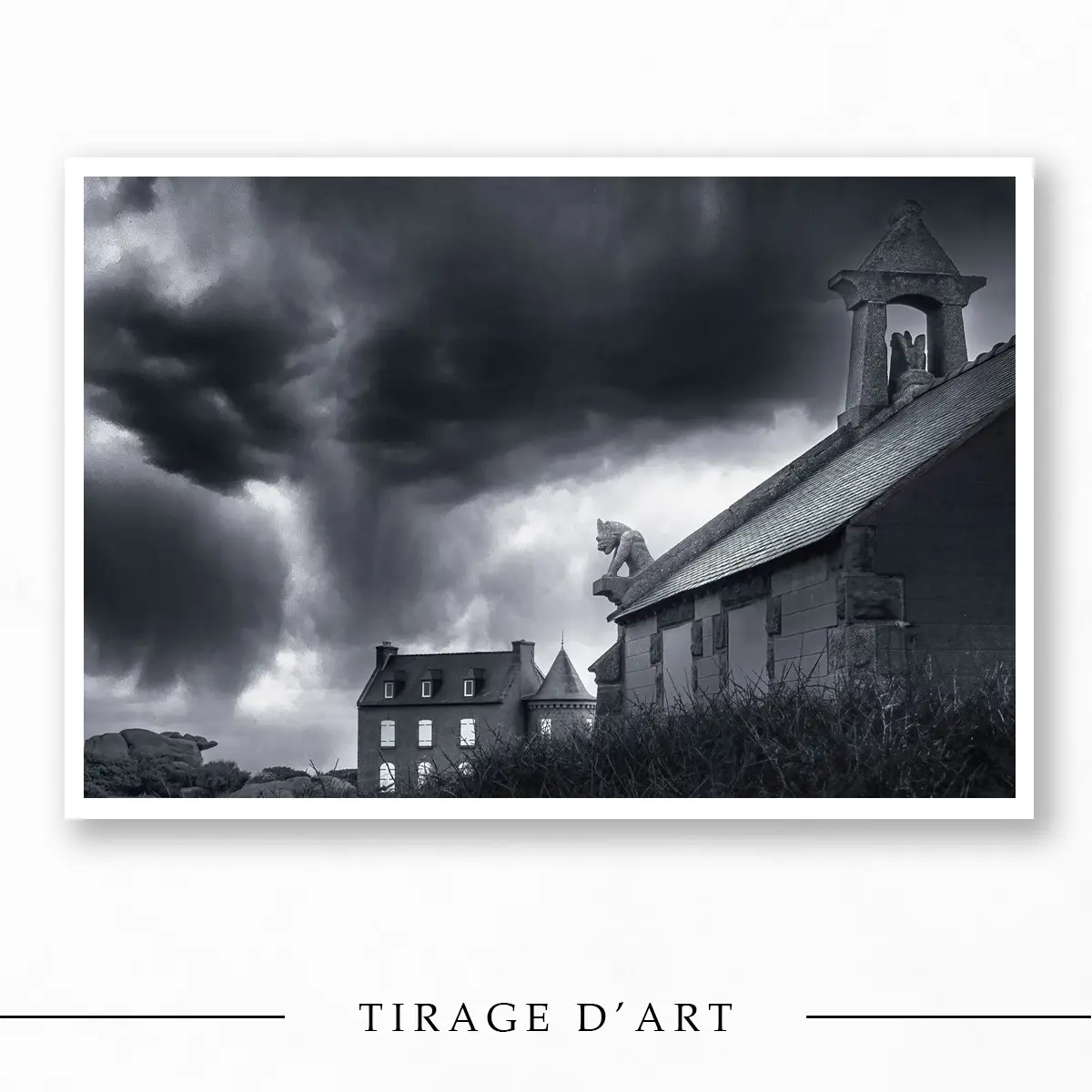
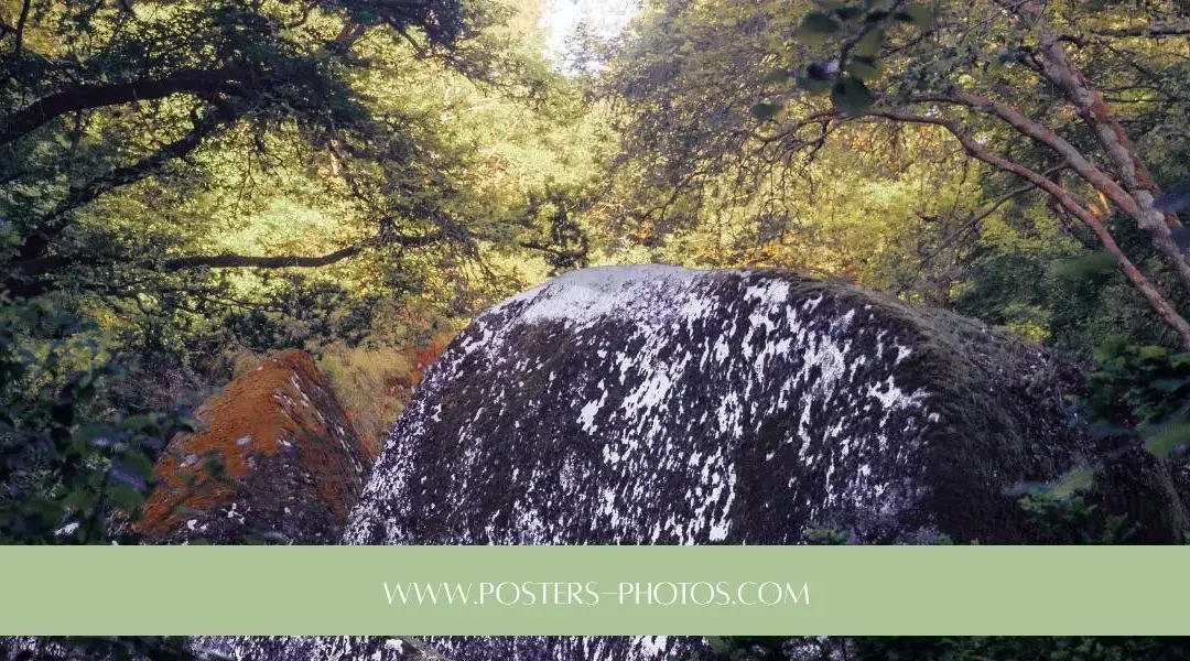
A Singular Vision of the Landscape: Blockhouse and Sea

What separates a photographic work of art from a simple image?

The Artist’s Vision as a Starting Point

A true fine art photograph is not born of chance. It does not seek to be a neutral visual observation or a documentary record. It always begins with a deliberate intention.

When I work on a series, whether it is a landscape or a more abstract composition, I do not seek to show "what the subject looks like" in an informative way. I seek to translate an atmosphere, a light, a sensation. I do not record reality; I interpret it.

Art Photo: Boat on Azure Sea – Loïc Delplanque Limited Edition 
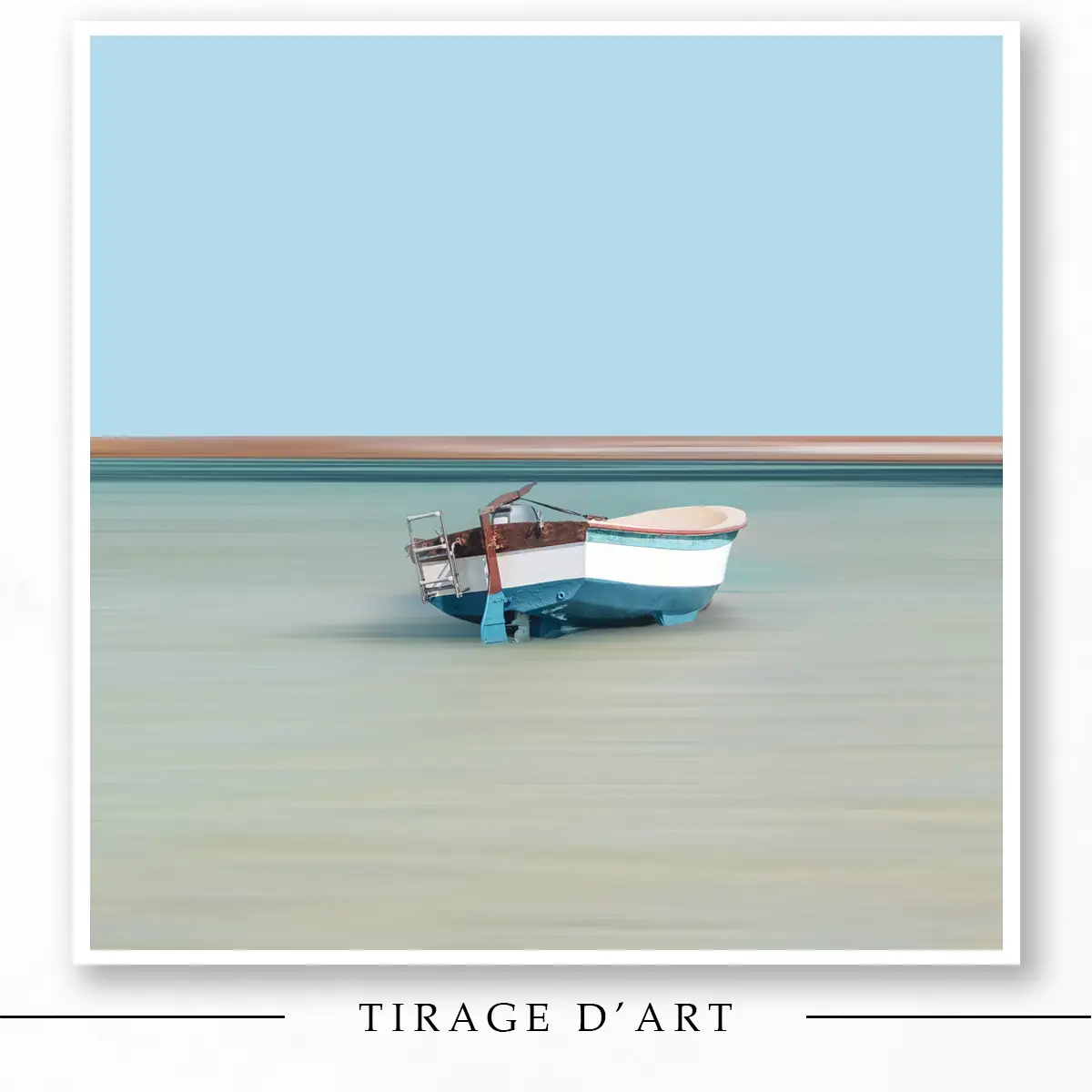
Minimalist Interpretation: Boat and Azure Sea

It is this assumed subjectivity that defines fine art photography. The artist chooses what to show, what to hide, and how to process it to align with their inner world. Without this singular vision, the image remains a simple reproduction of the world.

Beyond Reproduction

Photojournalism aims to inform. Advertising photography aims to sell. Fine art photography, on the other hand, aims to express and to question.

Technique is a tool at the service of meaning, never an end in itself. A technically perfect image (sharp, well-exposed) can be boring if it says nothing. Conversely, the history of photography is full of examples where blur or grain are used intentionally to create emotion. What matters is not academic perfection, but the accuracy of the artistic message.

The Expression of a Sensibility

Your camera is like a brush or a pen. Every setting, every framing is a choice of radical exclusion.

In my own photographic approach, I sometimes go as far as drawing directly onto the photograph with a graphics tablet. This is not to correct the image, but to extend the narrative, adding a poetic or graphic dimension that optics alone could not capture. This is what a fully realized fine art photography approach is: using every possible means to impose one's vision, regardless of the subject.

How does the artist's intent materialize into a work of art?

The Fine Art Print: The Transition to Reality

Fine Art Photography: Fishing Boat in the Mist – Mysterious Atmosphere 
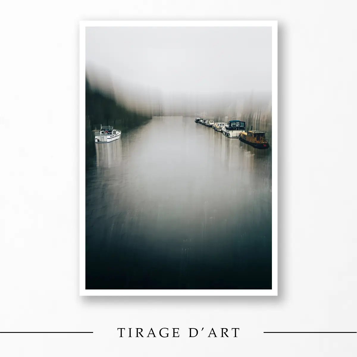
Dreamlike Atmosphere: Boat in the Mist

As long as it remains on a hard drive or a memory card, the image is virtual. It does not truly exist physically. The fine art print is the crucial moment when artistic photography takes shape.

It is not a simple "print." It is the tangible culmination of the creative process. The printing process fixes the image onto a lasting medium, giving it texture, depth, and a physical presence. This is what allows the work to endure through time and leave the ephemeral flow of screens.

The Artist's Control

If we are to speak of'work of art, The print must be made by the artist or under his supervision. In practice, this means that I leave nothing to chance.

I work with a trusted art laboratory whose processes and papers I have validated. I know the rendering of my files perfectly. This mastery of the graphic chain ensures that the work you receive is exactly the one I imagined.

Fine Art Print vs Standard Print

It is vital not to confuse a decorative poster with a fine art photography print.

  • Standard Printing is a consumer product. It uses basic paper and standard inks with a limited lifespan (a few years before yellowing or fading).
  • The Fine Art Print is a collector's item. It uses certified Fine Art papers (such as the Hahnemühle paper I use for my editions) and pigment inks, ensuring museum-quality preservation over several generations.

What criteria transform a print into an official work of art?

Fine Art Photo Print: Deauville Fisherman – Floating Frame (American Box) 
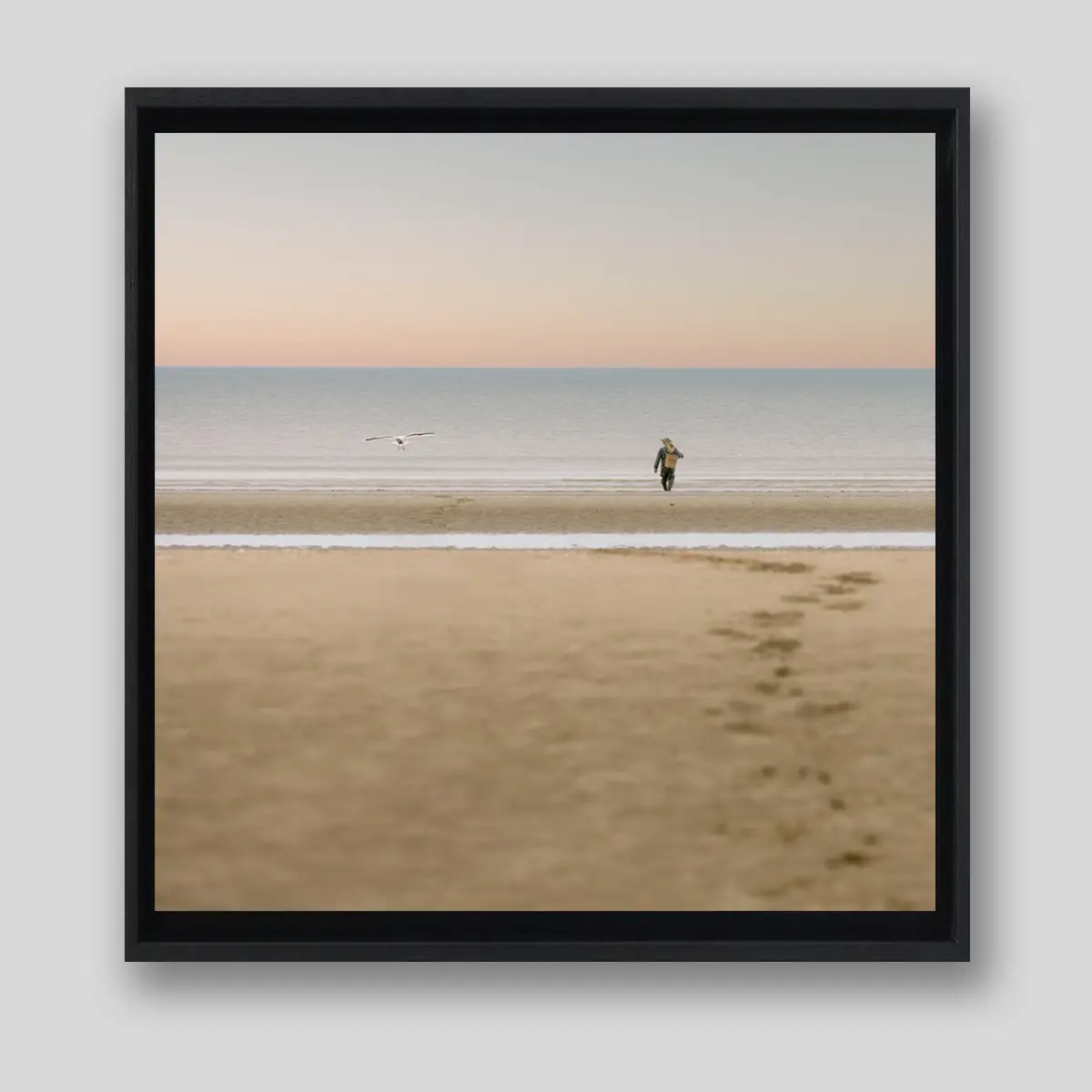
Timeless Scene: The Deauville Fisherman

The Signature

The handwritten signature is the act of authentication par excellence. By signing a print, the artist commits their responsibility and their name. They certify that this piece conforms to their vision and validate its quality. It is the direct and indelible link between the creator and the collector.

Numbering and Limited Edition

It is the most important criterion for defining value. A work cannot be produced indefinitely. The principle is simple: the artist commits to a maximum number of prints for a given image.

In my practice, I have chosen to limit my editions to 30 copies, in all formats, so that my photographs can be fully considered as works of art.

Why did you make this choice? It's an approach that affirms my artistic commitment by reinforcing the exclusivity and rarity of each print. When you see "5/30" on one of my photographs, it means that you own the 5th copy and that there will never be more than 30 in the world, signed by my hand.

This rarity is contractual, guaranteed and definitive. It is this mechanism that protects the value of your acquisition over time and makes each print a genuine collector's item, a far cry from unlimited industrial production.

The certificate of authenticity

It is the work's true identity card. It must accompany every fine art photography print and specify:

  • The title of the work and the artist's name
  • The print number (e.g., 5/30) and the total number of planned copies
  • The type of paper and the printing technique used
  • The artist's signature

On posters-photos.com, no limited edition work is delivered without this essential document. It is the basis of trust and traceability.

CriterionFine Art Photography (Fine Art Print)Standard Print / Poster
IntentionUnique author's visionDecorative reproduction
PrintLimited and numbered (generally < 30 for tax purposes, sometimes up to 50+)Unlimited (mass production)
SignatureHandwritten by the artistOften absent or printed
PaperFine Art (Cotton, Baryta) - Museum QualityStandard photo paper or poster
Lifespan> 100 years (pigment inks)A few years (dye-based inks)
ValueCollector's item / HeritageConsumable / Ephemeral decoration

Are support and printing simple technical details?

The choice of paper: an artistic decision

Paper is never a neutral medium in fine art photography. It has a "hand," a texture, and its own color that influences the final result.

A baryta paper offers strong contrasts, deep blacks, and a slightly satin finish, ideal for intense black and white or graphic images. A textured matte paper (such as watercolor or "rag") provides a softness, a velvet-like quality, and a very different substance.

I choose the paper specifically according to the image, not out of habit. For certain atmospheric series, a matte paper reinforces the pictorial aspect. For an architectural or high-contrast image, a baryta paper will be more impactful. The paper is an integral part of the work.

Pigment inks: durability

In fine art printing, classic office inks are not used. Pigment inks are composed of solid color particles in suspension.

Unlike dyes that penetrate the paper, pigments fix themselves on the surface and are extremely stable. The result: exceptional chromatic accuracy and, above all, a light resistance of over 100 years. This is the guarantee that your fine art photography will remain as vibrant as on the first day for future generations.

How does rarity build the value of a photograph?

Fine art photography Port Haliguen Quiberon Lighthouse Brittany - Signed fine art print 
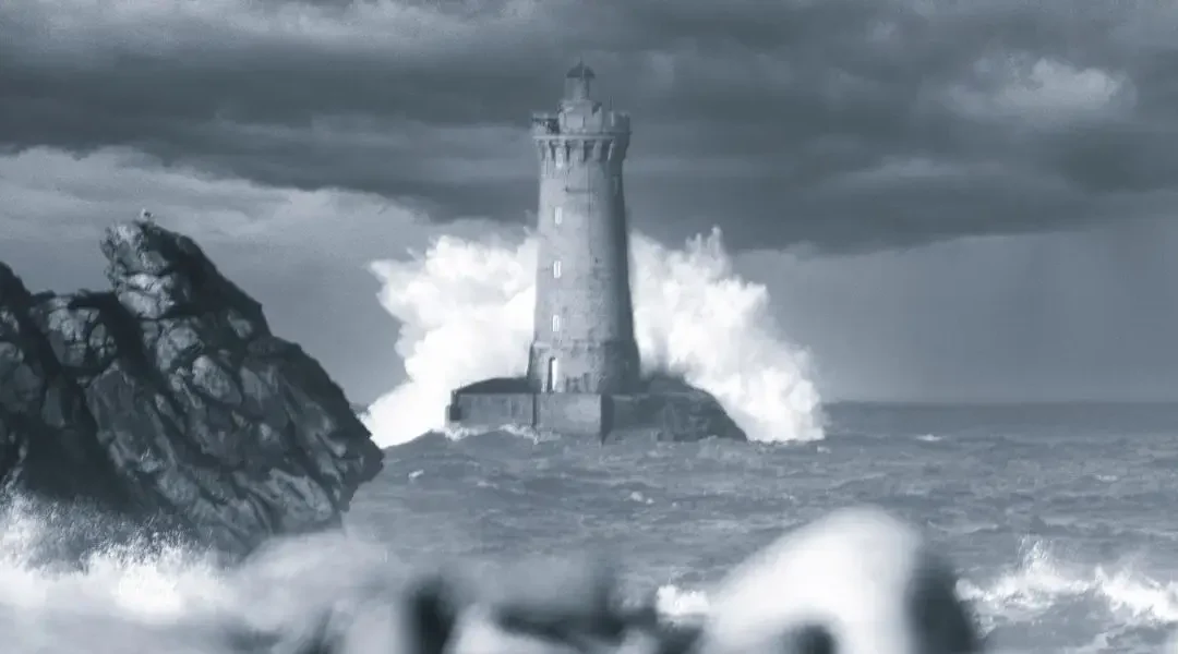
Port Haliguen Lighthouse - Signed fine art print

Limited edition as a guarantee

The value of a work on the market relies heavily on the law of supply and demand. By strictly limiting the supply (the number of copies), a mechanical rarity is created.

Limited edition is a strong moral contract. The artist formally refrains from reprinting the image once the announced quota is reached. If you own one of 30 copies of a fine art photograph, you have the certainty of holding a rare object that will never be devalued.

Progressive numbering

It is common in the fine art photography world for the price of a work to evolve as the edition sells out. The first numbers are often offered at a "discovery" price to reward the early collectors who trust the work. The last numbers of the series, having mechanically become very rare, see their value increase significantly.

Artist's proofs (AP)

There are sometimes a few non-commercial prints, marked EA (Épreuve d'Artiste) or AP (Artist Proof). They are traditionally reserved for the author, their archives, or their close circle. Their extreme rarity makes them pieces that are sometimes highly sought after by savvy collectors, as they are closest to the artist's personal work.

What other factors transform a photo into an investment?

The artist's notoriety

It is an obvious factor: an artist's "standing" influences the price of their fine art photography. Gallery exhibitions, press features or art books, awards, and peer recognition build this standing over time.

However, buying only a 'standing' is not enough. Above all, you must buy a work that speaks to you. Supporting a photographer whose work touches you is often the best emotional and financial investment, as you directly participate in their artistic development.

The consistency of the work

An isolated image often has less impact than an image that is part of a coherent and thoughtful series. Fine art photography collectors often seek works that are representative of the artist's style and approach.

In my work, whether it involves landscape, graphic, or mixed media series (photo/drawing), I always strive for consistency in treatment, light, and atmosphere. This common thread is what allows an author's "signature style" to be recognized at first glance.

Is the value of a fine art photograph purely monetary?

Emotional value above all else

Before discussing financial investment, we must speak of emotional investment. A fine art photograph is meant to live with you in your daily life.

It should stop you in your tracks as you walk by. It should take you on a journey, make you reflect, or simply soothe you after a difficult day. It is this personal and intimate connection that constitutes the true value of a work within your home.

Cultural value

A photograph is also a witness. It bears witness to an era, a place, and a unique perspective on the world. It possesses a heritage and cultural dimension. Hanging an artist's work is not just about decorating a wall. It is about affirming your tastes, supporting creation, and bringing a piece of artistic sensitivity into your home.

The key stages of fine art photography (Infographic)

Educational computer graphics: the 3 stages in creating an artistic photograph, from vision to authentication. 
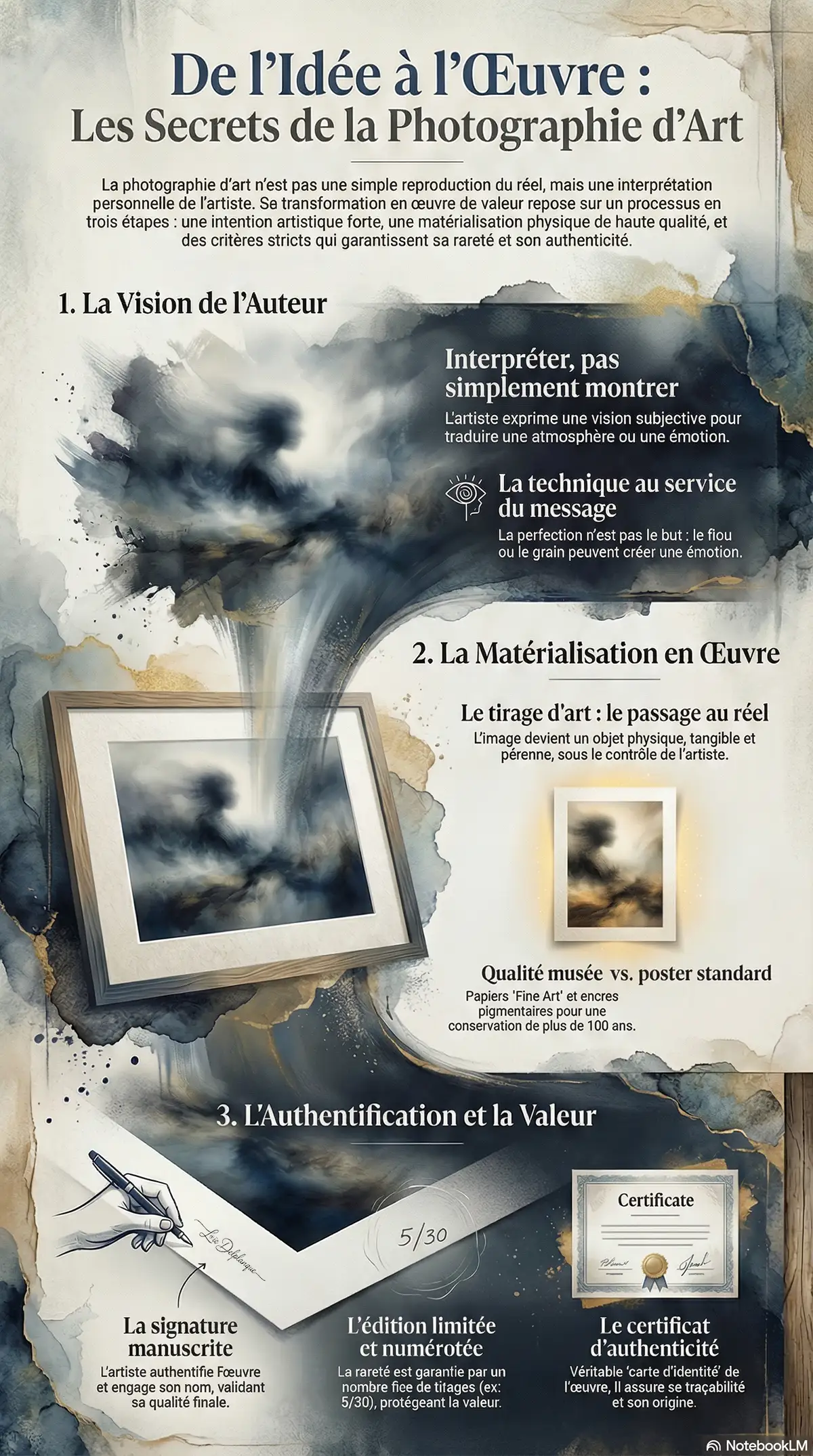
Infographic: The journey of a work of art, from the author's vision to the guarantee of its value.

Ultimately, what defines a successful photographic work?

A successful fine art photograph is the perfect alignment between a strong intention (the substance) and impeccable technical execution (the form).

It is that moment when the artist's vision is served and enhanced by a masterfully crafted print. When nothing is left to chance, from the initial framing to the final choice of paper. A successful work is one that continues to speak to you and move you long after it has been hung.

If you wish to discover how I concretely manifest this vision, I invite you to browse my limited editions on the shop or to discover my approaches in photo report. You will see how I use my perspective to transform your projects or decorations with art images where intention comes first.

Now that you understand what gives a genuine artistic photograph its value, discover my limited edition collections. Each print is a finished piece, combining ICM photography and graphic tablet drawing – a process that allows me to offer rare images, with real intention.

Our art photography categories

I propose several universes to help you find a photograph that matches your decor and your emotions:

Black and white artistic photography Brittany limited edition fine art print

Artistic black and white photography

My black and white prints allow me to offer a clean collection around several themes: architecture, minimalism, Brittany.

Discover my artistic black and white photographs
Contemporary art photography ICM modern art print limited edition

Contemporary artistic photography

My creations blend photographic techniques (ICM — Intentional Camera Movement) and digital drawing.

Explore my contemporary collection
Fine art photography Brittany seascape limited edition print

Artistic photography Brittany

Brittany is a playground I know well. I photograph very different locations there: shipwrecks, cliffs, lighthouses or calmer scenes.

See my artistic photographs of Brittany

Pourquoi acheter une photographie d'art ?

  • ✓ Limited Edition — Each print is numbered and signed
  • ✓ Personal work — ICM photography and drawing combined
  • ✓ Art print — fine art printing with framing option
  • ✓ Certificate of authenticity provided with each print

Fine art photography FAQ

What's the difference between an art photo and a poster?

The difference lies in intention, rarity, and production quality. A poster is an unlimited industrial reproduction on standard paper. A fine art photograph (or art print) is a work limited to 30 copies, signed by the artist, and printed on Fine Art paper with pigment inks guaranteed for 100 years.

Why limit a fine art photograph?

Limitation is what guarantees the exclusivity and value of your acquisition. I have chosen to set this threshold at 50 copies (all formats combined) to offer an ideal balance: a rare work that will never be commoditized, while remaining accessible to collectors. Once this number is reached, the image will never be published again.

What is a certificate of authenticity?

It is an official document that must accompany the sale of a fine art photograph. It guarantees the work's origin and specifies its title, the artist's name, the print number within the series, as well as technical details (paper, printing). It is the "registration certificate" of your artwork.

Why use Hahnemühle paper?

Hahnemühle is a global reference for Fine Art papers. Their papers (often based on cotton or alpha-cellulose) offer a unique texture, excellent "hand" (thickness), and above all, an absence of acid that guarantees the paper will not yellow or degrade over time. It is a standard of museum quality.

Forest of Brocéliande: what to see, what to do, how to prepare your visit

Forest of Brocéliande: what to see, what to do, how to prepare your visit

📋 In this article

  • -A “First visit to the Brocéliande forest” booklet to download free of charge: simplified map and practical resources to prepare your outing and keep a personal record of your visit.
  • -
  • Where is the Brocéliande forest? Understanding the differences between Paimpont, Tréhorenteuc, Comper and Monteneuf, and how to find your way around.
  • -Must-see places for a first visit Val sans Retour, Merlin's tomb, Barenton fountain, Comper castle and pond, etc.
  • -Ready-made day ideas Depending on the time you have available and the way you travel (family, hiking, short stopover).
  • -The essentials of legends and history A few stories about Merlin, Morgana and Viviane, and some historical landmarks to help you read the landscape.

Your “First visit to Brocéliande Forest” booklet - Free

🌳

Your «First visit to the Forest of Brocéliande» booklet»
A little guide to take with you, with practical information, the main places to see and Google Maps links to help you prepare for your first day in Brocéliande.
In this booklet you will find :
  • ✅ A short presentation the forest of Brocéliande and its great legends.
  • ✅ The right tourist offices with their addresses and direct links to Google Maps.
  • ✅ Places not to be missed for a first visit, each with its own Google Maps link.
  • ✅ And for your little ones some forest-inspired drawings to print out, to keep them busy on the journey 😉

📩 How does it work?
  • Leave your email below - the guide is sent to you immediately, PDF file.
  • 📬 2 times a month, Here you can read stories about Brittany, photography and what goes on behind the scenes of my work.
  • 🚪 Unsubscribe in one click, at any time, without question or delay.

After your visit, extend the experience with my limited edition photographs of Brittany's forests.

🌲 Where is the Brocéliande forest?

Woman looking at a map to find the forest of Brocéliande

On the maps, look for “Paimpont forest” rather than “Brocéliande”: the massif lies to the west of Rennes, between Ille-et-Vilaine and Morbihan.

Over the centuries, writers and scholars have identified this very real forest with the Broceliande of Arthurian texts, and today almost everyone refers to Paimpont and the surrounding legendary sites as “Broceliande”.

For you, this means one very concrete thing: there isn't “one” single entrance, but a group of places scattered around Paimpont, Tréhorenteuc, Comper, Concoret or Monteneuf, which together form what is known today as the Brocéliande forest.

Forest of Brocéliande: must-sees

Here are the places I return to most often, and which I think give a good first impression of Broceliande.

Golden tree and waterfall in the Brocéliande forest

The Golden Tree, a unique symbol of the Brocéliande forest, overlooks the Val sans Retour waterfall in Brittany. ©Loïc Delplanque

Location / setWhat it is in a nutshellWhy go there
Val sans retour & Arbre d'Or A valley near Tréhorenteuc associated with the fairy Morgane, with the Miroir aux Fées and the Arbre d'Or, installed after a fire in 1990. A loop that combines the Miroir aux Fées, the crest of the valley, the Arbre d'Or and typical views of moorland and red shale.
Merlin's Tomb & Fountain of Youth Situated between Paimpont and Saint-Malon-sur-Mel, with an ancient megalithic monument interpreted as Merlin's tomb and a nearby spring. For a short walk on an easy forest path, passing by the Tomb and then the fountain, with a few explanations on the spot.
Barenton fountain Forest spring accessible from Folle-Pensée (commune of Saint-Malon-sur-Mel), with a basin, a stone slab and a path through the undergrowth. An out-and-back walk of around 45 minutes to 1 hour on a forest path in a quieter area, ideal if you're looking for a cool, shady spot.
Porte des Secrets (Paimpont) An indoor show tour of Paimpont Abbey, taking you through several rooms dedicated to Brocéliande: forest ranger, forest, korrigans, forge, master tree and an area dedicated to Destination Brocéliande. An immersive experience lasting around 1 hour, combining sounds, lights, models and stories about the forest, its legends, its trades and current issues, before or after your walks.
Centre de l'Imaginaire Arthurien (Comper) Château de Comper near Concoret, on the edge of a pond, offering exhibitions, storytelling walks and events based on the Arthurian cycle. Combine a visit to the château with a walk around the lake, with a programme that changes with the season (temporary exhibitions, events, storytelling).

What to do in the Brocéliande forest according to your profile

Family in the forest with a compass, choosing what to do in the Forest of Brocéliande

A first “discovery” day”

For a first contact, I often recommend : Paimpont (abbey, pond, Porte des Secrets), then the Val sans Retour from Tréhorenteuc.
In just one day, you can combine village life, staged legends and great scenery, without spending too much time in the car.

2 or 3 days to go further

Over two or three days, you can add the Tombeau de Merlin / Fontaine de Jouvence, Barenton, Comper or Monteneuf sectors, leaving time for quieter stops.
The idea is not to do everything one after the other, but to leave a little margin for unforeseen events and stops that will make you want to stay longer in one place.

Coming with the family

With children, I advise you to focus on places where stories and legends are at the heart of the visit: Porte des Secrets, storytelling walks, Centre de l'Imaginaire Arthurien, Val sans Retour, Comper.
These are places where you can talk about Merlin, Morgana, Viviane or the korrigans with something concrete in front of you, which brings the forest to life for them.

Medieval festivals and markets in Brocéliande: not-to-be-missed events

To fully immerse yourself in this world, there's nothing like taking part in the festivals and medieval re-enactments which regularly enliven the communes of Paimpont, Guer or Tréhorenteuc.

These encounters transform the forest into an open-air theatre where history meets fiction.

You can come across troupes of enthusiasts bringing to life the tournaments of chivalry or the banquets of yesteryear, adding a carnal dimension to the tales of the past. Round Table.


Medieval market in the Brocéliande forest - stalls selling local produce and a festive atmosphere in Paimpont

Highlights include Arthurian Weeks organised by the Centre de l'Imaginaire Arthurien at Château de Comper are a must.

This cycle of events offers conferences and storytelling performances and themed exhibitions which go into more detail on the topics covered on this page.

It's the perfect opportunity to understand how the myth of Merlin or the Lady of the Lake continues to influence contemporary culture while enjoying a festive, family-friendly atmosphere.

In summer, don't miss the medieval markets and the night walks that punctuate the local calendar.

These festivities provide an opportunity to discover the’arts and crafts and the Celtic legends , and soak up a little more of the magic of Brocéliande.

Legends and history: the basics for understanding the forest

The great legends to keep in mind

Before coming, knowing a few stories really helps you to get into the atmosphere of Brocéliande.

Illustration of Merlin the Magician in the Forest of Broceliande

Merlin and Viviane

Viviane is also known as the Lady of the Lake; both names refer to the same character in Arthurian stories.

Comper is said to live in a crystal palace invisible to humans, hidden beneath the surface of the pond, and that Merlin helped her to create it.

This link between Viviane, Merlin and the “castle under the lake” is a fairly recent interpretation of the legend, particularly in the Centre de l'Imaginaire Arthurien and the scenography around Comper, but it works very well when you're facing the water.

To put it simply, Merlin falls in love with Viviane, passes on his magical secrets to her, and it is with this magic that she ends up locking him up for eternity, a little further on in the forest, near what is known today as Merlin's Tomb or Viviane's Hospice.

Morgane and the Valley of No Return

In Arthurian stories, Morgana is King Arthur's half-sister: she is taught by Merlin and learns the art of spells from him.

Armed with this magic, she shapes a small valley in the forest of Broceliande into the Val sans Retour, an enchanted place where knights who betray the love they have sworn are trapped.

Lancelot is the only one to cross this valley without giving in to the enchantment, because he remains faithful to Guinevere; by breaking the spell, he frees all those whom Morgana had been keeping there for years.

Fairy-like young woman in the forest, inspired by Morgane de Brocéliande
Korrigan near a waterfall in the Brocéliande forest

The korrigans, little creatures of the forest

The korrigans are little creatures from Breton legends, sometimes mischievous, sometimes protective, who live near stones, springs and paths.

They are said to enjoy leading distracted walkers astray, playing with time or hiding treasures, making them great allies for inventing stories while walking with children.

Merlin, the fairy Viviane, King Arthur... Find out all about these stories in my full article on the legends of Brocéliande.

A few facts about the history of the Brocéliande forest

The Broceliande of books is based on a very real forest: the Paimpont massif, exploited and transformed for centuries.

For centuries, the forges of Paimpont used wood from the forest and a network of artificial ponds to turn their machines, and traces of this can still be seen around the Forges site and along certain paths.

They were the most important wood forges in Brittany from the 18th century onwards, and operated until the end of the 19th century.

In the 20th century and more recently, several major fires have affected Paimpont: the one in 1990, followed by the summer of 2022, left a strong mark on the massif and the Val sans Retour sector, reminding us just how fragile this forest remains.

When I return to these paths, I see both the areas still scarred by the fire and the regrowth that is coming back, and this has clearly changed the way I photograph Brocéliande.

Ponthus beech, a remarkable tree in the Brocéliande forest

Photographing the Brocéliande forest: a few tips

Majestic old oak in the Brocéliande forest

Loïc Delplanque - All rights reserved

What interests me most in photography is the intention.

Now that you know this forest a little better, you'll probably photograph it differently, trying to bring out the magic that it inspires in you.

A few ideas to bring out the magic of the place

Play with soft light and mist: come early in the morning, when the light is lower and the mist clings to the moors or ponds; it's often this that really tips the image into something more mysterious.


  • Use vertical wire in undergrowth : A slightly longer exposure and a slight up and down movement transform the trunks into an unreal subject, echoing the legends of the forest.
  • Try a long exposure on the water: Streams and small waterfalls become smoother and milder, adding to the unreal feel of certain sites.
  • The important thing is the emotion you want to convey: a light, a detail, an atmosphere. Once you're there, think first about what the scene evokes in you, then about how to photograph it.

My most beautiful photos of forests in Brittany

ircle cx="12" cy="12" r="10"> Click on a photo to find out more
The 8 Most Beautiful Forests in Brittany: Hikes & Itineraries 2025

The 8 Most Beautiful Forests in Brittany: Hikes & Itineraries 2025

📋 In this article

  • -8 exceptional Breton forests Huelgoat, Brocéliande, Quénécan, Camors, Fougères, Cranou, Beffou and Pont-Calleck
  • -Interactive Google Maps 20 forests in Brittany with GPS parking and points of interest
  • -Interactive route generator 24 forestry routes with duration, level, historical anecdotes and Visorando links
  • -Exceptional heritage rocky chaos, Arthurian legends, Neolithic megaliths, 17th-19th century industrial forges
  • -Professional photo advice ICM techniques, panoramas, backlighting, golden hour and best light spots

🌲 Interactive map: 20 Forests of Brittany

🗺️ Interactive map (20 forests of Brittany) - This map shows the 8 forests detailed in the article plus 12 alternatives to explore. Find car parks with precise GPS coordinates and major points of interest in each forest.

🎲 Want to discover a forest in Brittany? Generate a surprise hike from our 24 most beautiful routes in Brittany's forests - with duration, level of difficulty, professional photo advice and a direct link to Visorando for each forest route.

🌲 Find your next hike in our beautiful Breton forests

Generate a surprise tour from our 30 best itineraries

🌊 Brittany direct to you?

Receive my exclusive articles on Brittany and discover my latest photographs of the region. Every month, you'll find great tips, secret places and my favourite Breton spots.

✓ Exclusive content - ✓ No spam - ✓ Easy unsubscribe

🌲 The 8 Most Beautiful Forests in Brittany

Brittany is home to some exceptional forests where legends, nature and history meet. Here are eight must-see forests with their own special features: rocky chaos, megaliths, historic forges, lakes and family trails. Each forest is presented with its location, car parks, routes and photo tips.

Forest n°1
Chaos of Huelgoat forest Finistère Bretagne

The granite chaos of Huelgoat, Finistère. Loïc Delplanque

🌲 Huelgoat (Finistère) - Le Chaos du Moulin

The Huelgoat Chaos was formed 300 million years ago, when the Earth's crust melted deep underground to form granite. This magma rose and cooled 6-8 km below the surface.

Over millions of years, erosion of the Hercynian chain has exposed this massive granite. Freezing, thawing and weathering then fractured the rock, creating this labyrinth of gigantic boulders - some weighing over 100 tonnes - now embedded in a dense forest.

Caption: Tradition has it that Gargantua knocked on the door of the inhabitants of Huelgoat to ask for lodging. They served him a meagre porridge of buckwheat. Vexed by this minimalist hospitality, the giant set off again towards Léon. To express his displeasure, he emptied his pockets of all the pebbles he had accumulated during his journey, throwing them angrily at the current site of chaos. A memorable anger that shaped the landscape for eternity.

📍 Practical Information

  • 📍 Location: Huelgoat, 29690 (Finistère)
  • 🅿️ Parking : Rue du Général De Gaulle - Free
  • ⏱️ Circuits : 1h (family) to 4h (full)
  • 📸 Optimum spotlight : Mare aux Sangliers

📍 Remarkable sites

  • Chaos du Moulin Huge blocks of granite piled up haphazardly, you weave between the rocks like in a labyrinth.
  • Mare aux Fées A magical and peaceful corner where you can watch dragonflies dance above the water
  • Mare aux Sangliers The wild boars from the forest used to come to bathe there, and if you look closely, the rounded, half-submerged rocks strangely resemble them.
  • Gouffre After the autumn rains, the water rushes in with impressive force.
  • Artus camp — The remains of an ancient Gallic fortified camp, a place steeped in history
  • Trembling Rock — A 100-tonne block that can be made to swing with a simple push of the hand

📸 Photo Council

Choose misty autumn mornings to recreate the magic of chaos. The low light under the canopy means you need to use a tripod and slow shutter speeds.

Forest no. 2
Arbre d'Or Brocéliande forest Val sans Retour Brittany

The Golden Tree at Val sans Retour, Brocéliande Forest, Paimpont © Loïc Delplanque

🏰 Brocéliande (Ille-et-Vilaine) - Les Légendes

The forest of Paimpont was known as Brécilien until the 15th century. Its identification with the legendary Brocéliande, an imaginary forest created by Chrétien de Troyes in the 12th century, was established in the mid-19th century thanks to the work of the scholar Félix Bellamy.

The area covers a total of 11,000 hectares, including 7,000 hectares of Arthurian sites. Shaped by three centuries of iron mining (17th-19th centuries), the area is still home to the ruins of old forges and the reservoirs that supplied the foundries with hydraulic power.

Caption: According to Arthurian tradition, the Barenton Fountain marks the first meeting place between Merlin the Enchanter and the fairy Viviane. Considered to be a marvellous fountain, pouring its water over the stone steps was supposed to bring rain. This popular belief led to numerous processions during periods of drought.

Discover my complete guide to the forest of Brocéliande, with all the must-see places, the Arthurian legends and my advice on preparing your visit.

📍 Practical Information

  • 📍 Location: Paimpont, 35380 (Ille-et-Vilaine)
  • 🅿️ Parking : Esplanade de Brocéliande - 48.0199, -2.1719 - Free admission
  • 🌳 Surface area : 9,000 hectares – Brittany's largest forest massif
  • ⏱️ Circuits : 2h to 6h depending on itinerary
  • 📸 Optimum spotlight : Barenton fountain (quiet morning)

📍 Remarkable sites

  • Barenton fountain The spring where, according to legend, Merlin first met Viviane
  • Guillotin oak A thousand-year-old oak, one of the last witnesses of the ancient forests.
  • Paimpont Abbey A medieval abbey in the heart of the town, the ideal starting point for discovering the forest.
  • Etang de l'Abbaye A body of water created during the time of the ironworks, right at the foot of the abbey
  • Val sans retour — The valley where the fairy Morgana kept unfaithful lovers, it is said
  • Merlin's tomb — A Neolithic dolmen that Arthurian legend has made its own

📸 Photo Council

Experiment with vertical filming (ICM) to capture the mystical atmosphere of Brocéliande. Set your shutter speed to 1/4s or 1/2s, then move the camera vertically during the exposure. The trunks become blurred lines, creating a dreamlike atmosphere reminiscent of Arthurian legends.

Forest no. 3
Lake Guerlédan Quénécan forest Brittany

Lake Guerlédan and Quénécan forest, Central Brittany. Loïc Delplanque

⛰️ Quénécan (Morbihan)

The Quénécan forest stretches over 3,700 hectares between Morbihan and Côtes-d'Armor, to the south of Lac de Guerlédan. Nicknamed "Brittany's Little Switzerland" for its undulating terrain, it is home to the Gorges du Daoulas, a natural canyon carved out by the river.

The massif is home to the Forges des Salles, an iron-making village founded in 1622-1623 by Henri II de Rohan. For more than 250 years, blast furnaces and forges transformed the local ore into cast iron using charcoal and hydraulic power.

Production ceased in 1877. The village has been completely restored and can now be visited freely or with a guide.

Industrial Heritage : Henri II de Rohan, a Protestant leader from Brittany, created the Forges des Salles in 1622 to put an end to the anarchic exploitation of local ore and to organise the extraction of iron, wood and water rationally. Blacksmiths, workers, charcoal burners and miners formed a complete village, and the working life of the 18th and 19th centuries has now been restored.

📍 Practical Information

  • 📍 Location: Sainte-Brigitte (56) / Perret (22)
  • 🅿️ Parking : (48.2149, -3.1298) - Free of charge
  • 🌳 Surface area : 3,700 hectares
  • ⏱️ Circuits : 2h to 4h depending on itinerary
  • 📸 Optimum spotlight : Daoulas gorges (viewpoint)

📍 Remarkable sites

  • Daoulas gorges - A natural canyon with steep walls
  • Lake Guerlédan - The largest artificial lake in Brittany
  • Bon-Repos Abbey - 12th-century Cistercian ruins
  • Forges des Salles - Restored steel village, open to visitors

📸 Photo Council

Create a panorama to show the full extent of the gorges. Take several shots by shifting the camera, then stitch them together in post-production.

Forest n°4
Camors forest Morbihan Brittany

Camors National Forest, Morbihan, Brittany. Loïc Delplanque

🗿 Camors (Morbihan)

The Camors state forest covers 648 hectares in the north of the Auray region. Accessible to all, it offers easy trails and calm ponds ideal for families.

The Camors state forest covers 648 hectares in the north of the AurThe forest is home to a number of Neolithic menhirs erected around 5,000 years ago, which probably marked territories or served as ritual landmarks. The forest boasts a full range of leisure facilities, including picnic areas, children's play areas and a tree climbing course.

Megalithic heritage : The Menhir Braz, nicknamed the "star menhir", measures 3.40 metres. Not far away stands the more modest Menhir Bihan, measuring 1.70 metres. Listed as historic monuments in 1934, they date back 5,000 years.

📍 Practical Information

  • 📍 Location: Camors, 56330 (Morbihan)
  • 🅿️ Parking : Site du Petit Bois - (47.8446, -3.0137) - Free admission
  • 🌳 Surface area : 648 hectares (national forest)
  • ⏱️ Circuits : 1 to 3 hours depending on itinerary
  • 📸 Optimum spotlight : Étang du Petit Bois (morning reflections)

📍 Remarkable sites

  • Braz menhir - Raised stone, 3.40 m high, listed as a historic monument
  • Menhir Bihan - Megalith measuring 1.70 m
  • Cornevec alignment - Fifty menhirs over 250 m
  • Covered walkway at Lann Er Vein - Neolithic burial chamber
  • Étang du Petit Bois - Family leisure area
  • Tortorec Cross - Old cross in the forest

📸 Photo Council

At dawn, the banks of the lake and the hamlets are adorned with changing reflections. Try your compositions with the first rays filtering through the trees.

Forest n°5
Fougères forest Ille-et-Vilaine Brittany

Fougères forest, Ille-et-Vilaine, Brittany. Photo Pixnio CC0 (Public domain)

🌳 Fougères (Ille-et-Vilaine)

The Fougères state forest covers 1,584 hectares to the north of the town, in the municipalities of Landéan and Laignelet. Made up mainly of hundred-year-old beech trees, it is one of the most beautiful beech forests in Brittany. The dense canopy of old beech trees filters out the light, creating a meditative atmosphere ideal for long walks.

Less touristy than Huelgoat or Brocéliande, it offers an authentic immersion in nature. During the Vendée War in 1793, the forest served as a refuge for royalist insurgents at the Battle of Fougères.

Historical heritage : The forest was the scene of the Battle of Fougères on 3 November 1793, during the Galerne expedition in the Vendée War. Royalist troops captured the town after fierce fighting.

📍 Practical Information

  • 📍 Location: Landéan / Laignelet, 35133 (Ille-et-Vilaine)
  • 🅿️ Parking : Chênedet crossroads (D177) - (48.3948, -1.1736) - Free of charge
  • 🌳 Surface area : 1,673 hectares (ONF state forest)
  • ⏱️ Circuits : 1 to 4 hours depending on itinerary
  • 📸 Optimum spotlight : Sentier de la Pierre Enfouie (undergrowth)

📍 Remarkable sites

  • The Buried Stone Trail - Signposted 5.5 km circuit, 1h30
  • Centenary beech trees - Majestic trees characteristic of the massif
  • Chênedet leisure centre - Pond, supervised swimming in summer
  • Cordon des Druides - Alignment of a dozen menhirs
  • Pierre Courcoulée (Pierre des Huguenots) - Neolithic megalith

📸 Photo Council

Old beech trees give off a soft, green light. Focus on details with a macro or telephoto lens: bark, roots, carpets of dead leaves.

Forest n°6
Forêt du Cranou Quimerc'h Finistère Brittany

Forêt du Cranou near Quimerc'h, Finistère, Brittany. Photo Wikimedia Commons Fabien Ropars / CC BY-SA 3.0

🌲 Cranou (Finistère) - Forêt Domaniale du Cranou

The Cranou state forest covers 627 hectares between Hanvec and Le Faou, in the Armorique Regional Nature Park. Including the adjacent communal woods and private plots, the total forest covers 1,321 hectares, making the Cranou the largest forest in Finistère.

Its altitude varies from 60 to 321 metres. Less frequented than other Breton forests, it attracts lovers of tranquillity. Crossed by the GR37, it offers a 3km interpretation trail and an 11-hectare forest arboretum.

⚠️ Attention: Since storm Ciaran, some small paths are no longer accessible and several bridges have been destroyed, making it difficult to cross the river without a bridge. The forest remains magnificent and accessible to dogs.

Legend of Saint Conval : Saint Conval, driven out of the Bois du Gars after cutting down the local lord's oak trees, took refuge in the Cranou forest. The new lord gave him permission to use all the trees. As a reward, the saint declared that there would never be a shortage of wood in the Cranou forest.

📍 Practical Information

  • 📍 Location: Hanvec / Le Faou, 29460 (Finistère)
  • 🅿️ Parking : Route de Rumengol (48.3158, -4.1010) - Free of charge
  • 🌳 Surface area : 627 ha (national forest) / 1,321 ha (total forest area)
  • ⛰️ Altitude : 60 to 321 metres
  • ⏱️ Circuits : 1h to 5h (GR37 + signposted routes)
  • 📸 Optimum spotlight : Forest arboretum (diversity of tree species)

📍 Remarkable sites

  • Saint-Conval fountain 17th-century devotional fountain in schist rubblework, housing a kersanton stone statue of the saint. Registered as a historic monument in 1956.
  • Saint-Conval Calvary Erected in 1627 by the sculptor Roland Doré, in kersanton stone. Only the shaft remains, the crosspiece has disappeared. The last vestige, along with the fountain, of a 15th-century chapel destroyed during the Second World War.
  • Forest Estate Tour — 12.5 km loop (3h10, moderate difficulty, 332m elevation gain) through oak and beech woods — Crozon Tourism
  • Forest Arboretum — 14 hectares of free access, created in 2008 to study the adaptation of trees to climate change. It succeeds a sylvetum from 1970 (ONF/INRA) and brings together more than 150 species from around the world.
  • GR37 footpath The long-distance footpath crosses the forest from one side to the other, through oak and beech groves.

📸 Photo Council

Stand at the base of a tall tree and photograph the top from a low angle: the tree dominates the image, accentuating its verticality.

Forest n°7
Beffou forest Côtes-d'Armor Brittany highest forest

Forêt départementale de Beffou, highest forest in Brittany, Côtes-d'Armor. Loïc Delplanque

🌲 Beffou (Côtes-d'Armor) - The highest forest in Brittany

The Beffou departmental forest covers more than 630 hectares in the municipalities of Loguivy-Plougras, La Chapelle-Neuve and Lohuec. Owned by the département since 1951, it is the highest forest in Brittany, with Le Pavé, the highest peak in Trégor at 322 metres, at its heart.

Managed by the ONF and classified as a sensitive natural area, it is dominated by beech trees (its name means "residence of the beeches" in Breton), with oak, chestnut and yew trees over a hundred years old. The constant humidity and dense canopy create a special atmosphere, with lush moss and subdued light. The Sentier de Job (Job Trail) is a 1.2 km trail through the fauna and flora.

Historical heritage : The forest is home to the Brohet covered walkway (18 metres long, one of the longest in Brittany), a collective grave dating back to the 3rd millennium BC. It is crossed by the old Roman road that linked Le Yaudet to Carhaix. Until the 18th century, Beffou was a thriving metallurgical centre. Coal and clog makers worked here until the early 20th century.

📍 Practical Information

  • 📍 Location: Loguivy-Plougras / La Chapelle-Neuve / Lohuec, 22780 (Côtes-d'Armor)
  • 🅿️ Parking : RD11 / allée forestière n°25 junction - Free - (48.4911, -3.4807)
  • 🌳 Surface area : More than 630 hectares (departmental forest)
  • ⛰️ Altitude : Highest point at 322 metres (le Pavé)
  • ⏱️ Circuits : 1 to 3 hours depending on route
  • 📸 Optimum spotlight : Job trail (yew and moss)

📍 Remarkable sites

  • Job's path - Interpretation trail 1.2 km, 1 hour
  • Le Pavé - Highest point in Trégor at 322 m
  • Allée couverte du Brohet - 18 m long (Neolithic tomb)
  • Centenary yews - Sacred trees of the Celts
  • Clogmaker's hut - Historical reconstruction

📸 Photo Council

For macros with soft, pastel bokeh, shoot in the undergrowth in the morning or at the end of the day when the ambient light is low. Use a wide aperture (f/2.8 to f/4) with a macro lens to isolate moss, fungi or insects from the background. Position yourself close to the subject with a distant, solid-coloured background: the diffuse green tones of the foliage will create dreamlike bubbles of light. Avoid direct sunlight.

Forest no. 8
Pontcallec forest river Morbihan Brittany

Pontcallec river in the Berné forest, Morbihan. Photo Wikimedia Commons Lanzonnet / CC BY-SA 3.0

🌲 Pontcallec (Morbihan) - Forêt Domaniale de Pont-Calleck

The Pont-Calleck state forest covers 541 hectares in the commune of Berné. Formerly owned by the Marquisate of Pontcallec, it became state property in 1963 and has been managed by the ONF since 1966. Listed as a Natura 2000 site, it occupies a plateau and hillsides on the right bank of the river Scorff, renowned for its trout, salmon and otters.

The poor, acidic granite soil is home mainly to pedunculate oak, beech and chestnut trees. The maximum altitude is 164 metres.

Historical heritage : The Pontkalleg valley preserves traces of the ancient seigneury established in 1281. The estate is home to Pontcalleck castle (private, closed in August), the chapels of Saint-Albaud and Sainte-Anne des Bois, the remains of a medieval hamlet, as well as the site of the old pond and the remains of the old forges that exploited the local wood and water from the Scorff.

📍 Practical Information

  • 📍 Location: Berné, 56240 (Morbihan)
  • 🅿️ Parking : Maison Forestière roundabout near Pont-Neuf (D110 & D204) - (47.9434, -3.3606) - Free of charge
  • 🌳 Surface area : 541 hectares (national forest)
  • ⛰️ Altitude : Maximum 164 metres
  • ⏱️ Circuits : 1h30 to 4h (16.9km Pontkalleg circuit)
  • 📸 Optimum spotlight : Site of the old pond

📍 Remarkable sites

  • River le Scorff — River classified Natura 2000, renowned for its Atlantic salmon, trout, and European otters
  • Pontcallec Castle — Former fortress of the marquisate, rebuilt under Louis XIII. It was here that the Marquis de Pontcallec prepared his famous conspiracy of 1720 against the Regent. Today, it is the mother house of the Dominican Sisters of the Holy Spirit (private property, closed in August)
  • Medieval hamlet Discovered in 1973 during a reforestation project by the National Forestry Office. Six hamlets comprising 59 buildings and 6 enclosures, occupied from the Iron Age to the 19th century.
  • Sainte-Anne des Bois Chapel Chapel of the Pontcallec estate, built in 1865
  • Saint-Albaud Chapel – Religious heritage along the Pontcallec valley route
  • Site of the old pond — Former ornamental pond of the lordly estate, now an open landscape in the heart of the forest
  • Remains of the forges Remains of the old forges that exploited the forest's timber in the 19th century, to the point of ruining it through excessive extraction.

📸 Photo Council

Polarising filter for your photographs on the river.

🌲 And now?

These 8 forests offer the best of Brittany. From the rocky chaos of Huelgoat to the beech forests of Fougères, from the legends of Brocéliande to the wild gorges of Quénécan, each has its own character. Choose your forest for your next weekend walk or hike.

If you were interested in this article, check out my photographs of Brittany.

📸 Discover My Photographs of Brittany

❓ Frequently Asked Questions

What is the most beautiful forest in Brittany?

Brocéliande remains the most emblematic with its Arthurian legends. Huelgoat impresses with its unique rocky chaos. Fougères seduces with its majestic beech forests. The choice is up to you: mystery, geology or wilderness.

What is the largest forest in Brittany?

The Brocéliande forest is the largest in Brittany at 9,000 hectares, located between Morbihan and Ille-et-Vilaine. The Fougères forest (1,600 hectares) is the largest state-owned forest in Brittany. Le Cranou (1,321 hectares) is the largest forest in Finistère.

What is the legendary forest of Brittany?

Brocéliande is THE legendary forest of Brittany. It is home to Merlin's tomb, the Barenton fountain, the Valley of No Return and the Golden Tree. Arthurian stories have mentioned this forest since the 12th century.

Which is the wildest corner of Brittany?

The forest of Quénécan offers the Daoulas gorges, a wild and unspoilt setting. Beffou, the highest forest in Brittany, reveals an almost underground atmosphere with its centuries-old yew trees and dense mosses. Cranou also offers some remote and authentic areas.

Which forests are ideal for families with children?

Camors and Brocéliande offer short circuits that are perfect for families. Huelgoat also offers accessible trails with fascinating rocky chaos for children. Avoid Fougères and Pontcallec (distances too long).

Which forest should you choose to photograph Brittany's landscapes?

Huelgoat for its rocky chaos, Brocéliande for its mysterious atmosphere, Fougères for its majestic beech forests, and Quénécan for its wild gorges. Each forest offers unique compositions depending on the light and the season.

Storms in Brittany: history, locations, images and prevention

Storms in Brittany: history, locations, images and prevention

Some of the photographs featured in this article are available for sale in limited editions and were produced by Loïc Delplanque, professional photographer in Morbihan.

Introduction

Photograph taken by Loïc Delplanque of a wave submerging the Le Conquet seawall during storm Justine.

Photography by Loïc Delplanque, on 30 January 2021, during the Justine storm in Le Conquet. A colossal wave crashed onto the sea wall.

Photos of storms in Brittany (limited edition)

These phenomena are part of everyday life in Brittany. They fascinate, worry, stupefy... And while we sometimes end up no longer paying attention to them, they remind us of our fragility and question our relationship with nature.

This article looks at the formation of storms and the storms that have hit Brittany over the years.
It looks at their impact on the coastline, the increased risks associated with climate change, and how the region is adapting to erosion.

This is a recurring phenomenon here. Brittany is one of the most exposed regions in France.

Situated at the junction of the English Channel and the Atlantic, it is regularly affected by very active lows from the North Atlantic. Winds Violent storms, huge swells, floods or power cuts: every winter brings its share of bad weather.

Ciaran, Lothar and other major events have left visible traces on the coastline, but also in the collective memory.

Outils Météo Tempêtes Bretagne : Real-time monitoring

Smartphone displaying a "Rainy Day" weather alert in front of a window covered in raindrops

Weather Brittany

Wind Force Calculator

Simply enter the wind speed and the calculator will display its strength directly on the Beaufort scale. This makes it easier to see what a 70 km/h wind really means.

🌊 Historical storms in Brittany

Weather events in the region since 1984

November 22–24, 1984
🌪️Storm of November 1984
Flooding, thrown pebbles, very strong winds
Zones : Landerneau, Breton coast
⚡ Up to 175 km/h
October 15–16, 1987
💨1987 hurricane
Major devastation, forests destroyed
Zones : Ouessant, Quimper, Finistère
⚡ 200 km/h (Ouessant), 187 km/h (Quimper)
January 25–26, 1990
🌀Daria storm
Violent winter storm
Zones : Belle-Île, Pointe du Raz
⚡ 176 km/h
3 February 1990
⛈️Herta storm
Second strongest storm in 50 years
Zones : Belle-Île, Pointe du Raz, Granville
⚡ Up to 170 km/h
December 26, 1999
Storm Lothar
Storm of the century (1st wave)
Zones : Ushant, Saint-Brieuc, Finistère
⚡ 184 km/h, 173 km/h
December 27, 1999
🌊Storm Martin
Storm of the century (2nd wave)
Zones : Southern Brittany, Loire-Atlantique
⚡ Violent winds
January 31, 2021
🌬️Tempête Justine
Flooding, outages, extreme conditions
Zones : Breton coast
⚡ Nearly 150 km/h
November 1–2, 2023
💥Ciarán storm
Exceptional, historic record
Zones : Pointe du Raz, Plougonvelin, Bréhat
⚡ 207 km/h (record)

The storms originate in the North Atlantic, generated by depressions resulting from the temperature differences between the poles and the tropics. The jet stream directs them towards Europe, with violent winds. Brittany, the western tip of France, is in the front line of these phenomena.

Since 1980, 182 storms have hit Brittany, according to Météo-France. According to Weather Brittany, the average is three per year. The 1987 hurricane, with its winds at 216 km/h, is still etched in people's memories. Archives mention a major episode as far back as 1287.

Port-Haliguen lighthouse at sunrise in Quiberon - artistic photography Lighthouses in Brittany

Read more about Breton storms

To extend this immersion in rough seas, discover our article dedicated to the lighthouses in Brittany History, access and ideas for walks around the sentinels that watch over the coast in all weathers.

A guide for each département: Finistère, Côtes-d'Armor, Morbihan and Ille-et-Vilaine.

Read the article on lighthouses in Brittany

7 memorable storms in Brittany

Photo of a hurricane seen from space, symbolic illustration of the 1984 hurricane
Satellite photo of a hurricane, used symbolically to illustrate the 1984 hurricane.

November 1984

On 22 and 23 November 1984, two storms hit the northern half of France, particularly the Brittany. At that time, naming them was not yet done in France or Europe.

The night of 23 to 24 November 1984 will go down in the annals of Brittany's meteorological history. An unusually intense storm hit the region, causing extensive damage and flooding along the coasts.

Gusts exceeded 150 km/h on the Breton coast, with peaks of up to 175 km/h in places.

The town centre of Landerneau, in the Finistère region of France, has been flooded. The raging waves threw tonnes of pebbles onto the coasts, changing the coastal landscape.

These extreme winds uprooted trees, damaged buildings and disrupted infrastructure.

To find out more

Hurricane of October 1987

The storm of 1987, nicknamed the "Hurricane of 1987", the storm hit Brittany and Normandy with exceptional force, leaving an indelible mark on the region's meteorological history.

An unusual weather episode

On the night of 15th to 16th October In 1987, an explosive low-pressure system swept across north-western France, generating exceptionally strong winds. In Brittany, gusts were measured at 200 km/h in Ushant and 187 km/h in Quimper.

But it was in Granville, on the neighbouring coast, that the absolute record of 216 km/h was recorded - a value that remains unbeaten to this day, even after the passage of Ciaran in 2023.

It left a lasting imprint: a quarter of Brittany's forests were destroyed, tens of thousands of homes were left without power, and material damage was estimated at nearly 23 billion francs nationwide.

Illustration of a storm in Brittany, with a lighthouse in turmoil, trees uprooted and a house damaged.

This illustrated infographic looks at the consequences of a storm on the Brittany coast.

The Breton landscape was profoundly altered. "The landscape resembled a field of ruins, like Verdun," recalled some inhabitants, struck by the extent of the damage. (source The weather channel)

Despite its intensity, the number of victims remained relatively limited due to a passage and a low tidal range. For many local residents, this night remains one of the most significant weather events of the century.

Considerable damage

The impact was devastating:

  • 15 people lost their lives in France.
  • The damage was estimated at around 23 billion francs at the time, or 3.5 billion euros.
  • Nearly a quarter of Brittany's forests have been destroyed.
An exceptional meteorological phenomenon!

Often mistakenly described as a hurricane, it was in fact a depression in the mid-latitudes. Its atmospheric pressure dropped to 948 hPa in Brest, a record since the station was created in 1945. Its speed, around 110 km/h, helped amplify its devastating effects.

A turning point in storm management

This extreme weather event marked a turning point in awareness of the weather threat in Brittany and Normandy.

It has led to improved warning systems and better preparedness for storms.

Paradoxically, ten years after the disaster, the forestry balance sheet has been positive, with almost complete reforestation of the destroyed areas and the appearance of 30,000 hectares of new forests.

The October 1987 hurricane remains etched in the collective memory as a reminder of the power of nature and the need for constant vigilance in the face of extreme meteorological phenomena.

Daria (25 and 26 January 1990)

Photo of storm Daria in 1990: cars driving along the Boulevard Barnaart in a sandstorm, wind force 12, towards Bloemendaal aan Zee and the Zeeweg.

Daria in January 1990: sandstorm on the Boulevard Barnaart (Netherlands), wind force 12. Fotopersbureau de Boer 

January 25–26, 1990. Storm Daria, also known as the Burns’ Day Storm, marked the beginning of a winter many Bretons won’t forget. This cyclone bomb hit hard, with gusts measured at 176 km/h at the Pointe du Raz and violent swells that shook the entire coastline from the English Channel to the Atlantic (source: Wikipedia).

And that was just the beginning. Daria paved the way for an impressive series of at least ten storms, including Vivian, Herta and Wiebke, which swept through the forests, destabilised the power grids and left a lasting mark on the memories of those who lived through them (source: Wikipedia).

93 dead in six countries. Daria didn't just shake the roofs, she changed lives. There were 45 deaths in the UK, 19 in the Netherlands, 10 in Belgium, 8 in France, 7 in Germany and 4 in Denmark. A brutal episode, the human consequences of which have left their mark on Europe (source: Wikipedia).

Herta (3 February 1990)

19/20 FR3 of 04 February 1990 - Deadly storm in France - Tempête Herta - Archive INA

19/20 FR3, 4 February 1990 - Herta, a murderous episode in France.
INA archive, available on YouTube.

Herta hit France in the middle of the day, an unusual passage for this type of phenomenon.

Devastating winds

It was the second strongest storm in 50 years in the northern part of the country.

From 9 a.m. onwards, extremely powerful winds swept across Brittany, reaching speeds of 167 km/h at the Pointe du Raz and 162km/h at Belle-Île-en-Mer. At the same time, Normandy was hit by gusts of up to 170 km/h in Granville.

As the storm moved inland, gusts reached 133 km/h at Nantes (Pays de la Loire) and 151 km/h at Cap de la Hève, near Le Havre in Seine-Maritime (Normandy). Herta then hit the Île-de-France region, where winds peaked at 158 km/h at Brétigny-sur-Orge.

A heavy human and material toll

In France, 23 people lost their lives that day. Among the regions hardest hit, Brittany was not spared.

In Herbignac, a resident recounts:

"The wind was blowing at over 120 kph continuously, gusting to 140 kph; a huge branch almost as wide as the road fell behind my car... My wife was shaking with fear, and scanned the windows hoping they would hold." (source: infoclimat)

In Pipriac, a lorry driver was killed when a tree fell. Three other people were seriously injured when bay windows were blown out during the storm.

Material damage was extensive: the church in Brielles lost its steeple, buildings were damaged in Rennes, and businesses suffered damage in Cancale and Vitré. Throughout the region, many trees were uprooted (source: Ouest France)

Lothar and Martin (December 1999)

Photo after storm Martin in December 1999 in Angoulême showing uprooted trees and clearing teams

Damage in Angoulême on the morning of 28 December 1999, after storm Martin.
Nicolas Dessaux - Personal work

Lothar and Martin, which hit Brittany on 26 and 27 September. December 1999, left their mark on the region's history with their exceptional violence. These meteorological events have been described as the "storms of the century" because of their intensity and considerable impact.

They have caused 140 deaths in Europe, including 92 in France alone.

Entire forests were destroyed, farms were severely damaged, and roofs were torn off. The power grid suffered heavy consequences, leaving some cities, including Rennes, without electricity for a time.

A dramatic accident claiming 4 victims on the RN12 was a reminder of the brutality of the events. More than 150,000 homes without electricity, emergency services overwhelmed... Lothar only lasted a few hours, but its passage left a stunned region. As this video shows.

Lothar struck the Breton coasts on December 26, bringing extraordinarily strong winds.

Record gusts were recorded:

  • 184 km/h on the island of Ouessant
  • 173 km/h in Saint-Brieuc, the regional record for this event
  • 158 km/h at Pleyber-Christ

There are many accounts of Lothar, and they all say the same thing: nobody was prepared for such violence.

On the night of 26 December 1999, Brittany was hit hard. In the Trégor region, residents woke to the sound of gusts of wind, discovering in the early hours of the morning roofs blown off, roads blocked and trees on the ground.

Martin followed the next day, 27 December, particularly affecting the south of Brittany.

It strikes a more southern area of Brittany than the first storm, but with similar strength.

It is having less of an impact on the region, but the Loire-Atlantic is suffering considerable damage, particularly to its forests.

The power grid is affected once again, while the estuaries and coasts experience flooding.

In Ille-et-Vilaine, the damage was extensive, and five people lost their lives: four in a vehicle hit by trees in Montauban, and another in Boussac, after the roof of her house collapsed.

(sources : The weather channel) - See photographs of storms in Brittany

Justine (30 January 2021)

Photograph of an incredible wave during the Justine storm in Brittany on the right and its framed image on the left

30 January 2021, storm Justine at Le Conquet. A powerful wave rises up, evoking the silhouette of a dragon. Photograph by Loïc Delplanque

Loïc Delplanque: “During storm Justine, the waves were hitting harder than usual. Soaked, I was heading back to the car when it emerged from the sea. What’s beautiful about waves, beyond the power they give off, is the imagination they spark. Some will see a simple wave, I see a dragon from the seas. And you, what do you see in this photo?”

Justine hit Brittany on 31 January 2021.

With winds reaching almost 150 km/h, it caused flooding, power cuts and property damage.

The coasts were violently battered by impressive waves. Residents had to cope with extreme weather conditions, a reminder of man's vulnerability in the face of nature.

Ciarán (1ᵉʳ to 2 November 2023)

Tempête Ciarán: la Bretagne face à l'urgence climatique - Enquêtes de région Le Mag - France 3 Bretagne

Enquêtes de région Le Mag: Tempête Ciarán - la Bretagne face à l'urgence climatique.
Report broadcast on France 3 Bretagne, presented by A. Masteau.
One year after the night of 1er to 2 November 2023, this documentary looks at the human, economic and climatic consequences of Ciarán in north-west France.

Ciarán, on the night of 1 to 2 November 2023, was exceptionally violent. Some media were quick to describe it as the "storm of the century".

Four people lost their lives in France during the passage of Ciarán. In Brittany, an Enedis technician died in Pont-Aven while working to restore electricity.

Extraordinarily strong winds

Ciarán generated gusts of wind of an intensity rarely seen in Brittany :

  • 207 km/h recorded at Pointe du Raz in Finistère, setting a new record
  • 193 km/h measured at Plougonvelin, also in Finistère
  • 180 km/h recorded on the island of Bréhat in the Côtes d'Armor

Even inland, the winds remained very violent:

  • 125 km/h at Rostrenen in Côtes d'Armor
  • 108 km/h recorded at Rennes in Ille-et-Vilaine
Extensive damage

The consequences of Ciarán have been devastating for the region:


  • Many trees uprooted and roofs damaged
  • Roads cut off and marinas devastated
  • Around 1.2 million homes without electricity in France, many of them in Brittany

I went to the Perharidy peninsula a few days after the storm. It had left its mark everywhere. Dozens of trees down, paths blocked, embankments gutted. It was a desolate sight.


We often hear about winds of over 200 km/h, power cuts and material damage. But when you're there, when you see these familiar landscapes disfigured, it takes you by storm. Every tree on the ground is a reminder of just how much can change overnight.


That day, I also learned that the Ponthus beech in the Brocéliande forest had also been felled. An emblematic tree, full of stories, walks and memories for many.

Key statistics

When we think of storms in Brittany, we often think of the wind. But it's not just the gusts. Some data are just as impressive

Wave crashes over a lighthouse in Brittany during a storm

Illustration of a Breton lighthouse in the face of bad weather: when the sea strikes relentlessly during a winter gale.

Unusual waves

Here are some of the record wave heights seen on Brittany's coasts in recent decades. All these heights come from precise measurements or reliable estimates:

- 24.60 metres. This is the height of a wave recorded at the Mare lighthouse during the winter of 2017-2018.
Sensors installed on site, combined with an image analysis system, have made it possible to measure it precisely. When you think of the isolation of this lighthouse on the open sea, you can imagine what it must feel like to be faced with such a mass of water, in the noise, wind and spray.
(Source: measurement campaign at La Jument lighthouse, winter 2017-2018 - see also Wikipedia entry on the lighthouse)

- 21.1 metres. This is the height of a wave measured off the coast of Finistère during the passage of storm Ciaran, on the night of 1 to 2 November 2023.

This value was recorded near the Pierres Noires buoy, south of Ushant, the most westerly point in mainland France.

The significant height of the waves had already reached 11.7 metres, but this isolated breaker exceeded 21 metres, the equivalent of a six-storey building.

This is an impressive figure, and a reminder of the violence of the phenomena on this part of the coast exposed to the great swells of the North Atlantic.

Inland too, the impact was brutal.

In Guingamp, Aurélie, aged 48, says she was woken up at 4am by "a huge noise". A tree in her garden split in two: "It didn't go far. Within a few degrees, it was a disaster...".


(Sources: The Weather Channel and Le Parisien via Aurélie's testimonial)

- 23.60 metres. This is what the Pierres Noires buoy measured during the Petra storm off Molène in early February 2014.
For more than ten hours, the waves stayed above 14 metres. A violence that did not stop at sea.

In Lomener, Ambroise Le Floc'h recalls: "the wind in the shutters, with the shutters slamming a lot; you can hear the swell hitting the sea wall...".


(Sources: Infoclimat, Le Point)

- 16 metres. That's the size of the waves recorded on Ouessant and Belle-Île-en-Mer during the storm of 16 October 1987, pushed by a long and powerful swell along the entire Breton coastline.
The sea level rose by 1.7 m in Brest and Le Conquet, despite a low tidal range.

Wave crashing on a lighthouse during a storm
A lighthouse alone against the elements: the sea rages on during a storm.

A number of residents still remember it:

"My grandmother lived in Cancale: her house shook in the gusts, right down to her bed. Even the windows vibrated", recalls a member of Infoclimat, recalling that night when the wind "cannonades" were raging and all the boats in the port of Concarneau were clinging to the ramparts.


A night when the sea and the wind spoke loudly - and all of Brittany had to listen.


(Sources: Wikipedia, Infoclimat)

- 17.7 metres above sea level - Jument lighthouse
On 3 January 2018, at the Jument lighthouse on Ushant, several exceptionally high waves - known as "scélérates" - were observed. One of them reached 17.7 metres above sea level, the height of its crest. The most impressive wave that day was measured at 24.6 metres from trough to crest.

(Sources: Wikipedia)

Where can you watch the storms in Brittany?

The most exposed areas

Brittany is one of the regions most exposed to storms, especially on its coasts.

Places like the Pointe du Raz, Ushant, the Crozon peninsula and the Bay of Mont-Saint-Michel regularly experience extreme conditions. Violent winds, high waves, exceptional tides and submersions follow one another every season.

During episodes like Ciarán, these areas were particularly hard hit. Some port cities, such as Brest, Lorient and Saint-Malo, regularly suffer major material damage.

Estuaries and low-lying areas remain vulnerable to flooding. In the face of these many dangers, the authorities are reminding people of the importance of constant vigilance.

The Four lighthouse

Photograph of a wave submerging the Four lighthouse under a stormy sky on the right and its framed image on the left

Photograph taken on 29 January 2020 by Loïc DelplanqueOn 30 January 2021, during the Justine storm in Le Conquet. A colossal wave crashes onto the sea wallduring a violent storm off the coast of the Four lighthouse. Its framed version is on display next door.


The Four lighthouseIt is well known for the huge waves that crash against its walls during storms. First lit in March 1874, it lies between the English Channel and the Atlantic.

It can be seen from the GR34 at Landunvez and Porspoder. Built over four years on the rock of Le Four, it resembles the Pierres Noires lighthouse. These twin lighthouses guide sailors through the dangerous Le Four channel.

At the Four lighthouse, the spectacle is as impressive as it is worrying. These phenomena can also be deadly.

On 27 April 1873, when construction of the lighthouse was not yet complete, a "dull wave" capsized a boat carrying supplies and materials, killing three sailors.

Despite the repeated assaults of the elements, the Le Four lighthouse has withstood the most extreme conditions.

Its sturdy construction and strategic position have enabled it to withstand the vagaries of the sea d'Iroise.

However, certain traces remain visible: on 1 February 1904, it was struck by lightning, causing extensive damage.

Even today, the Four lighthouse remains a symbol of resilience in the face of the waves.

The wild Morbihan coast

Photo of a wave submerging a rock on the wild Morbihan coast on the right and its framed interpretation on the left

Photograph taken on 21 October 2022 by Loïc Delplanque on the wild Morbihan coast. A huge wave submerges a rock off the coast.


The wild coast of Morbihan, with its steep cliffs and secluded beaches, it is often exposed to the raging elements, particularly during the winter months.

These extreme weather phenomena are characterised by powerful winds and impressive waves that shape the coastal landscape.

The storms on this coast can generate gusts frequently exceeding 100 km/h, with records sometimes reaching 150 km/h during the most intense episodes.

These violent winds, combined with the particular topography of the coast, create spectacular and dangerous sea conditions.

The waves generated by these storms can reach considerable heights, sometimes in excess of 10 metres.

These extreme conditions often attract curious onlookers and photographers, but represent a real danger to the safety of people and coastal infrastructures.

The local authorities regularly take precautionary measures during these events, such as closing certain access points to the coast or issuing warnings to the population.

The Côte Sauvage du Morbihan also lives to the rhythm of these phenomena, sometimes violent.

Storms and climate: understanding the issues

Illustration of a boat approaching a lighthouse at sea

Maritime illustration - A sailboat sails by a lighthouse in the sunshine.

The role of climate change

Climate change is already making itself felt in Brittany, with warming of +1.4°C since the 1960s. By 2100, the rise could reach +4°C.

Years such as 2022, which are considered very warm today, would then become rather cool years.

Droughts will be longer and more intense: soils will remain dry for an extra month, and their intensity could rise by 47 %. Conversely, winter rainfall will increase by 14 %, with more frequent extreme events (+9 to 44 %), which will increase the likelihood of flooding.

River flows will fall by 37 % at the end of the summer, extending the low-water period (when water levels are at their lowest) by a month.

Sea levels could rise by between 36 and 69 cm, making flooding more frequent.

The Atlantic Ocean, which is warmer and more acidic, will experience marine heat waves more often.

And forest fires could gain 25 days a year of favourable conditions.
An increasingly contrasted climate, between water shortages and sudden excesses.

Impact of global warming on storms

Climate models predict a northward shift in trajectories, with more intense winds in winter.

In Brittany, this type of change comes on top of other effects of global warming - rising sea levels, more vulnerable coasts, more extreme rainfall. The following points outline the main impacts.

Illustration of global warming with the Earth sitting on a desert floor under a blazing sun

Global warming - Illustration showing the Earth in character, affected by drought and heat.

Global warming : Since the end of the 19th century, the sea level in Brest has risen by around 30 cm, according to available tide gauge measurements. This rise has accelerated over the last few decades, reflecting a global trend linked to climate change global warming.

Coastal vulnerability : The low-lying areas of Brittany's coastline, as well as certain islands, are particularly exposed to the risk of marine submersion. Communities such as Treffiagat in Finistère have had to demolish houses threatened by coastal erosion and rising sea levels.

Intensification of extreme events : Global warming is leading to an increase in the frequency and intensity of extreme rainfall events, as well as accelerating coastal erosion. These phenomena are being observed in Brittany, where episodes of heavy rain are becoming more frequent and more intense.

Shifting storm tracks : Climate models predict a northward shift in trajectories in the North Atlantic, which could modify Brittany's exposure to these events. This development is linked to changes in atmospheric currents brought about by global warming.

Combined impact on the communes of Brittany : The rise in sea level, combined with the intensification of storms, is increasing the threat to many of Brittany's communes. Although the figure of 93 communes is mentioned in some reports, it is important to note that exposure varies depending on the locality and the protection measures in place.

In Brittany, rising sea levels combined with increasingly violent weather episodes are already exposing more than 130,000 residents to the risk of marine submersion.

This phenomenon threatens low-lying areas and islands in particular, with potentially serious consequences for infrastructure and local populations.

Illustration showing the different stages of coastal erosion on a cliff
Four stages in the erosion of a coastal cliff, from the initial wall to the formation of an arch and then an isolated needle.

Coastal erosion: a phenomenon amplified by climate change

Brittany, with its 2,470 km of natural coastline, is particularly exposed to coastal erosion.

This phenomenon, already long-standing, is now exacerbated by rising sea levels and the intensification of storms, direct consequences of warming.

According to Cerema, around 9% of the Finistère coastline, or 120 km, is affected by erosion, mainly impacting sandy and loose coasts.

Brittany's coastal communities face major challenges in adapting their urban planning and protecting their infrastructure.

In response, the Brittany region adopted in February 2024 a guidance document to help local authorities integrate erosion risks into their local planning policies — a first in France on this scale.

Illustration of a woman watering a pot with a dollar coin sticking out of it
Economic growth - Illustration used to illustrate the financial consequences of the storms in Brittany.

Economic and environmental consequences

Coastal erosion in Brittany is having a significant economic impact.

Damage to infrastructure, housing and economic activities such as tourism and oyster farming represents significant costs for local authorities.

For example, the storms of winter 2013-2014 caused considerable damage to the Breton coastline, requiring substantial investment in repairs and the introduction of protective measures.

Environmentally, erosion disrupts coastal ecosystems, leading to loss of biodiversity and degradation of natural habitats.

The disappearance of dunes and wetlands reduces the natural capacity of the coastline to absorb the impact of tides and storms. climatic increasing the vulnerability of these areas.

Measures to protect and adapt the area

Local authorities in Brittany are implementing integrated coastline management strategies (i.e. they are taking into account the entire coastline, its uses and natural changes), relying on the natural resilience of ecosystems (their ability to regenerate or adapt in the face of storms, erosion or rising sea levels).

The Litto'Risques partnership helps local authorities in Finistère to adapt to changes in the coastline.

Based on local observation and awareness-raising, it proposes technical solutions to municipalities vulnerable to erosion.

Brittany's storms, from the hurricane of 1987 to Ciaran, reveal a history marked by strong winds. violent and property damage.

Faced with rising sea levels and intensifying climatic phenomena, Brittany is adapting its protection strategies, such as the Litto'Risques partnership.

Understanding these issues will enable us to better anticipate hazards, preserve our coasts and ensure the resilience of an area where the nature, unpredictable, demands respect and vigilance.

Brittany in the face of storms: a Thalassa report

Video Living with the storm in Brittany - Thalassa
Living with the storm in Brittany - report by Thalassa (France 3), published in early 2023

Brittany has always lived with storms. They are part of its identity, its landscape and its collective memory.

But with global warming, their frequency, intensity and consequences are changing. Floods, submersions, extreme winds, impressive swells... everything is getting worse.

Observing, understanding and anticipating these phenomena is becoming essential. Not to give in to alarmism, but to adapt - intelligently.

Because every piece of data, every reading, every weather map becomes a little compass to help us live better in a land where nature sometimes imposes its own rules.

My storm photos from Brittany

Certain images come from moments where the sea takes over completely. High waves, strong winds, unstable light: these scenes are part of my work on storms in Brittany.

Storm Justine giant wave at Le Conquet

Storm Justine - wave at Le Conquet.

Storm wild coast Morbihan immense wave

Wild Coast — Morbihan, massive wave.

Storm Brittany wave on sea wall

Mist on the dyke — Brittany in storm.

Storm at the Four Lighthouse in Brittany, black and white

Phare du Four — storm in black and white.

Frequently Asked Questions about Storms in Brittany

What is the strongest storm ever recorded in Brittany?

The storm of October 15, 1987, is often considered the most violent to have hit Brittany. Wind gusts reaching 200 km/h were recorded in Ouessant, causing significant material and forest damage.

What was the biggest storm in France?

Since 1980, storm Lothar, at the end of December 1999, is considered to have been the most severe storm to hit France. It swept across the north of the country, with gusts often exceeding 140 km/h, from Brittany to Alsace.

Other notable storms include Martin (December 1999), Klaus (January 2009), Xynthia (February 2010) and more recently Ciaran (November 2023), each of which left its mark in terms of intensity and damage caused.

How many storms hit Brittany each year?

The number of storms affecting Brittany varies considerably from year to year.

Some years, the region can be hit by several storms, while other years are calmer.

Since 1980, more than 180 events have been recorded across the entire region.

Which areas in Brittany are most exposed to storms?

The coasts of Finistère, such as Ouessant, Pointe du Raz, or Plougonvelin, are among the most exposed areas. The wild coast of Morbihan, Belle-Île, and the Breton islands are also regularly affected.

Where will you be living in Brittany in 2050?

It is difficult to identify absolutely "safe" areas in Brittany in 2050, but low-lying coastal areas are the most threatened by rising sea levels. water. Sites such as the islands of Molène, Sein and Glénan and parts of the coastline around Morlaix could disappear.

Areas inland and at a higher altitude are preferable. It is crucial to take into account the risk of uninsurability of certain properties, particularly in Northern Brittany and on the Mediterranean coast.

When do storms most often occur in Brittany?

The storms mainly hit Brittany between November and March, when the Atlantic lows are most active.

How do storms affect fishing in Brittany?

Storms in Brittany have a significant impact on fishing. They can sweep away entire ships, resulting in the loss of human lives, as the history of the Terre-Neuvas testifies.

The storm of 1930 is considered to be the deadliest of the 20th century for the French navy. More than 200 fishermen, mainly from Brittany, lost their lives when their dinghies were caught in a violent storm south of Ireland.

English: Is climate change making storms more frequent or more intense?

There is as yet no scientific consensus on a significant increase in the frequency or severity of the disease. intensity storms in Brittany.

On the other hand, some studies suggest that weather systems are becoming more unstable, with phenomena that are sometimes more localised or intense.

What should you do in case of a weather alert in Brittany?

It is recommended to stay sheltered in a solid building, to close shutters and windows, and to limit movement. Outdoor objects, vehicles, and important documents must be secured. It is also advisable to prepare a flashlight, a battery-powered radio, drinking water, and any necessary medical treatments. In case of alert, follow the instructions of the authorities, avoid using the phone to avoid overloading the lines, and do not take the car, even to pick up a loved one.

Where can you get information during a storm in Brittany?

The websites of Météo-France, the prefectures, and the official social media accounts of local authorities provide real-time alerts and instructions. Local radio stations also remain a reliable source of information in case of internet outages.

0
    0
    Your basket
    Your basket is emptyBack to the shop